The ultimate itinerary for an epic Tassie lap

Six unforgettable months exploring Tasmania’s wild places, turned into the ultimate six-week island adventure.

We arrived in Tasmania on the cusp of winter with a one-way ferry ticket and a hunger for adventure.

In true Franky Roams style, we wanted to explore deeply, not just tick off the usual tourist hotspots.

Over six unforgettable months, we experienced a fiery Dark Mofo winter, explored Hobart like locals with housesits, tackled three multi-day hikes in 30 days, wandered through endless gorges, alpine peaks, misty waterfalls and heritage streets, and soaked up a wild and windswept coastline.

We have condensed the absolute best of six incredible months into an epic itinerary for a six-week Tassie trip of a lifetime.

How to use the itinerary?

No sweat if you don’t have six months to spare. We’ve suggested timeframes for each location, so you can easily pick out some standout destinations to form your own bucket-list vacay.

We just hope it inspires you to discover the magic of Tasmania — a rugged, dramatically beautiful, and truly wild place.

Table of Contents

Davenport to Hobart (255km, 2 days)

If arriving by ferry, take the Heritage Highway down the guts of Tassie from Launceston to Hobart, and explore each town’s picturesque heritage streets. Here’s our Heritage Highway highlights.
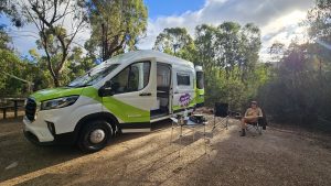
Evandale

  • Evandale Sunday Market – Tassie’s longest-running and largest Sunday market with all the good vibes!

Ross

  • Ross Female Factory, which offers up an interesting glimpse into Tasmania’s convict history.
  • The historic convict-built Ross Bridge – completed in 1836 and Australia’s third oldest.
  • Ross Village Bakery, which serves up some amazing award-winning vanilla slice!

Oatlands

  • Camping on the shores of Lake Dulverton – a beautiful bird sanctuary.
  • Exploring Australia’s biggest collection of sandstone Georgian buildings – almost 90 were built by convicts in the 1800s (get the ‘Oatlands Key’ from council to access several impressive buildings).
  • The Callington Mill Distillery for a self-guided tour (they also do a unique whisky tasting experience and restaurant meals).

Where we stayed

We utilised free, short-stay RV parks run by local councils, including:

  • Blackburn Park, Campbell Town
  • Falls Park Reserve, Evandale
  • Station Park (Green Ponds), Kempton

Hobart and surrounds (3 days)

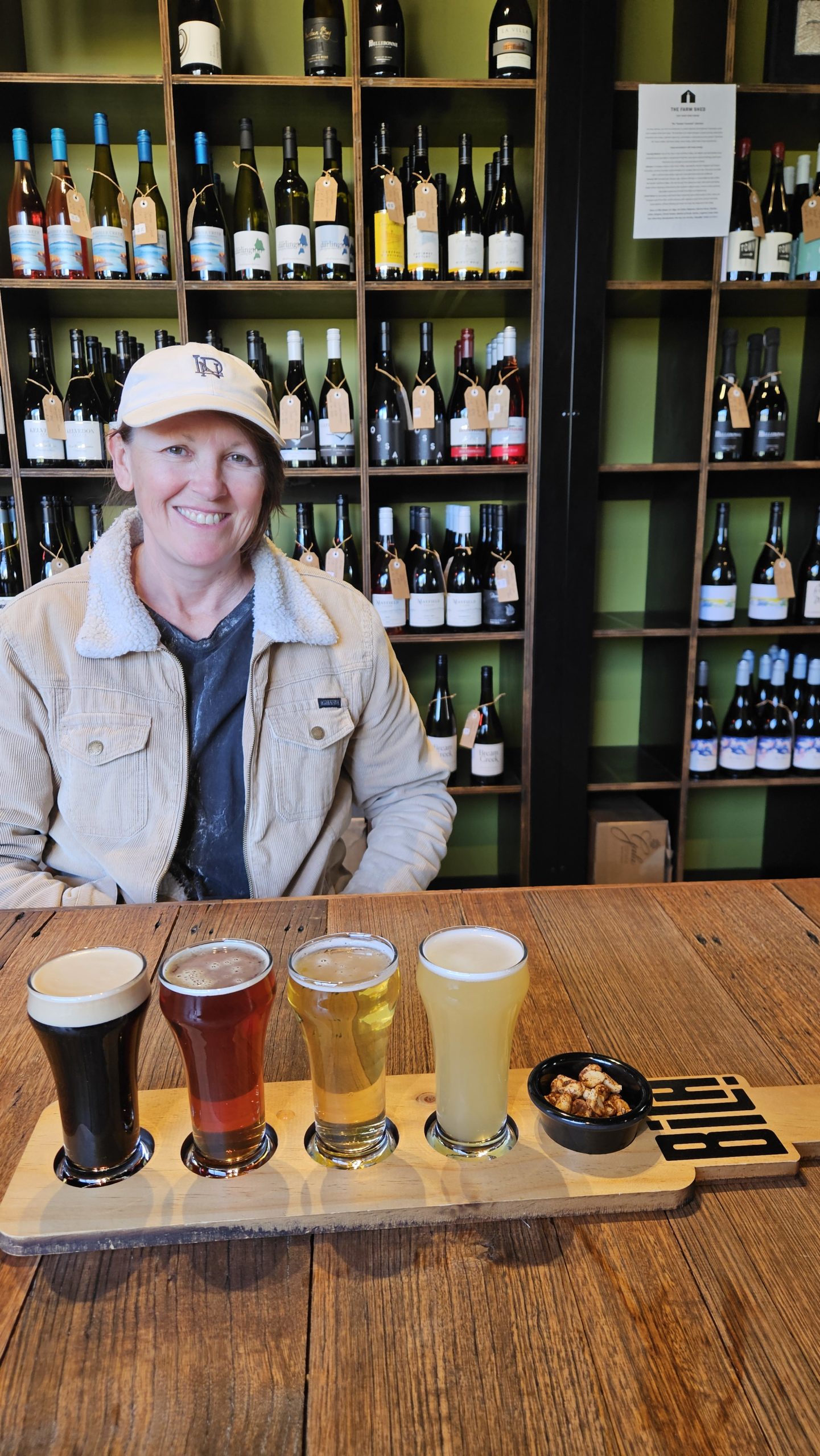
We came to Tassie in search of a winter like no other – and Hobart served it up in the bucket loads. It was weird, wild and wonderful – in equal measure!  Here’s our highlights.

Dark Mofo

  • An epic festival (think fire, food, art and music)!
  • Highlights: Dark Park (festival hub), Winter Feast (fiery banquet, free after 9pm), Nude Winter Solstice Swim, Hanging Garden (awesome venue) and Night Mass (a holy labyrinth of crimson, fire and beats).

Mount Wellington / Kunanyi

  • Stacks of walks starting from The Springs (including the stunning Organ Pipes Circuit, Pinnacle and Zig Zag Tracks) and the best chai latte going at Lost Freight.
  • Plus, the 6km O’Gradys and Silver Fallsloop trail loop trail.
  • Mt Wellington in snow is magic (you’ll need to park lower down and head in on foot).

Coastal Gems

  • Kingston Beach and Blackmans Bay – Stunning coastal walks and beachfront cafes with a chilled vibe.
  • Seven Mile Beach – Scenic walking tracks including the Clarence Coastal Trail (3.3km one way) and Single Hill Track (5.3km return).

Markets

  • Cygnet Market – Enjoy the buzzing main street vibe.
  • Salamanca Market – Get there before 10am to avoid the crowds.
  • Farm Gate Market – ‘Farmy’ is a Sunday brekky ritual for many locals – delectable baked goods and music.

Mona (Museum of Old and New Art)

  • Make sure you stick around for the 4pm project (live performance), sneak in a wine tasting (Moorilla Cellar Door), enjoy live music on the lawns or by the fire, unconventional dining or bevvy at Faro (in-situ experimental performances).
  • Download ‘The O’ app for all things Mona. Step things up a notch and arrive by Posh Pit on the Mona Roma ferry.

Longley International Hotel

Bakeries

Hunting down the best local baked goods served as a tasty mission. Here’s some of our top bakery finds:

  • Summer Kitchen Bakery (Ranelagh) – Carrot cake + croissants = next level. Plus, this cozy spot has all the good vibes!
  • Pigeon Whole Bakers (Hobart) – Their Morning Bun is the ultimate flaky, buttery, cinnamon-honey dream.
  • Jackman & McRoss (Battery Point) – Pies that pack a punch and croissants that melt in your mouth.
  • Six Russell Bakes (Sandy Bay) – Their five-spice sugar crullers: think cinnamon donuts…but yummier.

Breweries

  • Cascade Brewery & bar – The best happy hour in town ($6 happy hour and 2-4-1 meals on Thurs).
  • Spotty Dog Brewery – Amazing chicken wings (half price on Wednesdays)!
  • Deep South Brewing Co. – yummo pizzas (2-4-1 pizzas on Tues) and $6 happy hour.
  • Hopfields Brewery (Margate) – Live music and rustic cellar door with great vibes.

Hobart waterfront

  • A picturesque stroll along the historic waterfront and fish and chips from the pontoons.

Where we stayed

We sought out Hobart housesits through Aussie House Sitters (save $10 on membership using code: V4MWR5). We also stayed at a couple of RV parks about 20 mins out:

  • Longley Hotel (free with a spend at the bar, 48hrs)
  • Sorell Council RV Park, Sorell (low-cost, 10 nights)

Richmond (50km return, 1 day)

This charming town definitely deserves a spot on your Tassie itinerary. While we did it as a day trip trip from Hobart, you could easily spend a night and delve deeper.

  • Richmond Bridge – this grand old bridge was built by convicts in 1825 and is Australia’s oldest.
  • Heritage walk – explore more than 50 Georgian buildings and the country’s oldest surviving Catholic church.
  • Nocton Vineyard – one of the best cellar door experiences we’ve had. If wine is your thing, there are plenty of cellar doors in this area to explore.

Hobart to Port Arthur (90km, 4 days)

Three Capes (DIY)

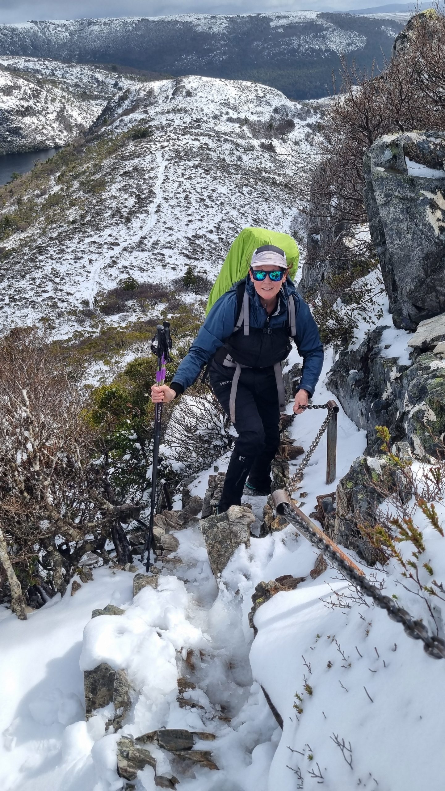
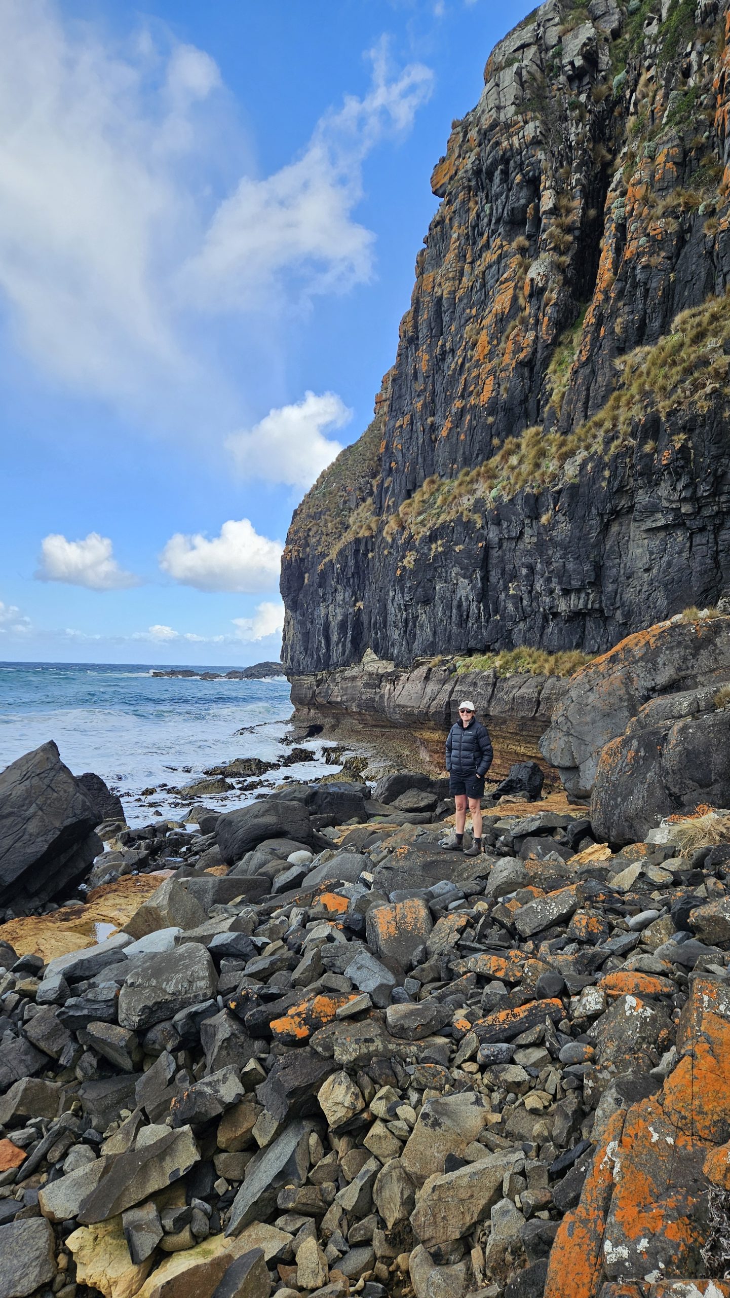
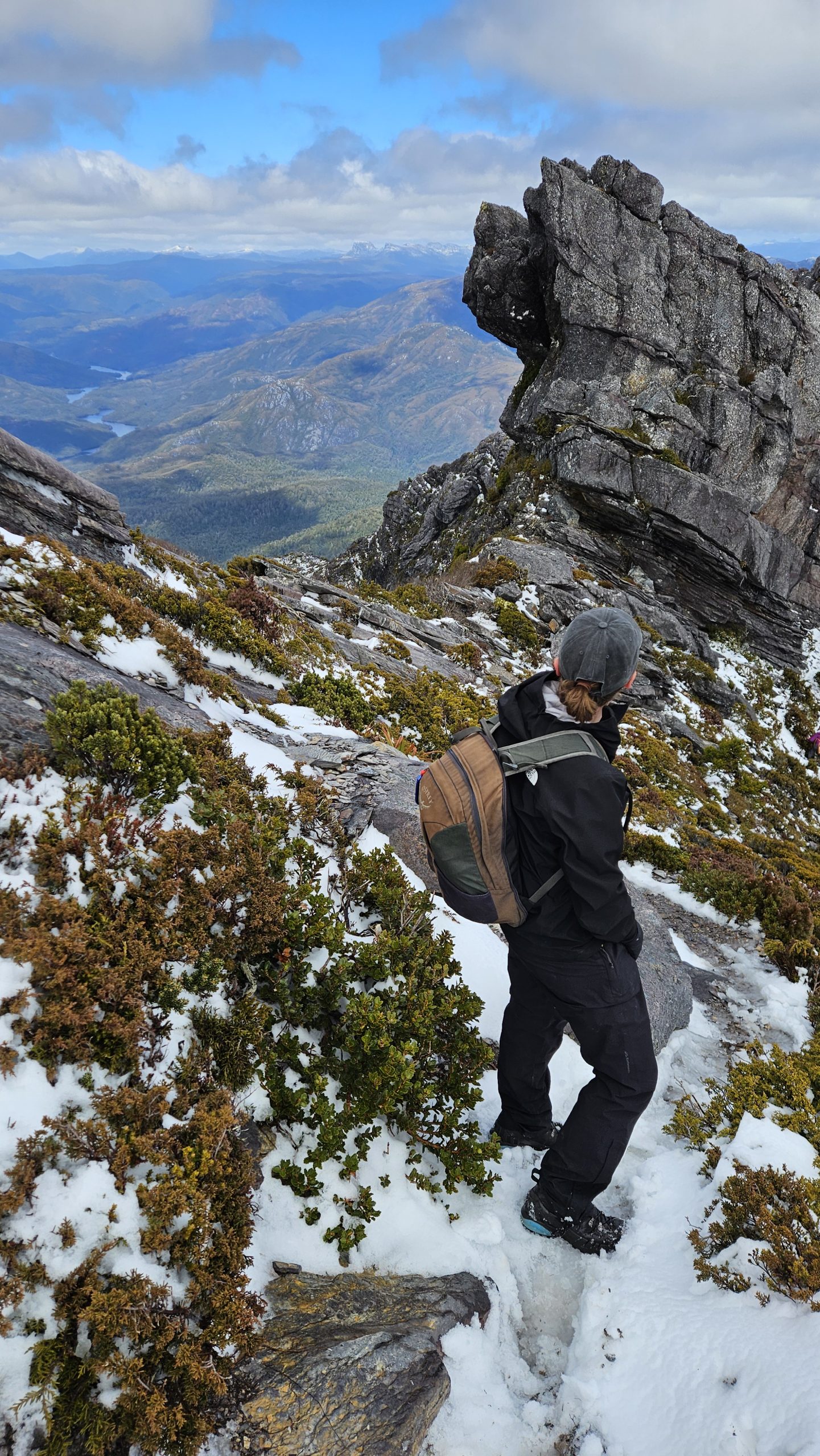
We undertook an epic 60km, four-day adventure on Tassie’s breathtakingly beautiful Tasman Peninsula. We stitched together our own journey to the tips of Cape Raoul, Cape Pillar and Cape Hauy – home to jaw-dropping dolerite cliffs, and the hauntingly beautiful Port Arthur Historic Site. The official Three Capes Track with its luxe cabins and boat trip looks amazing, but we went full vanlife and created a budget-friendly DIY adventure instead.

Cape Raoul (Day 1)

  • 5hr, 11km drive from Hobart to the Cape Raoul trailhead
  • 5hr, 16.5km in-and-out hike to Cape Raoul and Shipsterns Lookout
  • Camped at the Port Arthur Tourist Park (to visit the nearby Port Arthur Historic Site)

Port Arthur (Day 2)

We spent 5 hours exploring the World Heritage-listed Port Arthur Historic Site – Australia’s largest and most intact convict settlement with over 30 historic buildings, museums, exhibitions and guided tours. Highlights included:

  • 45 min guided Port Arthur Essentials Tour ($10 well spent – a good way to set the scene at the start of your visit)
  • complimentary 20 min scenic harbour cruise and self-guided audio experience
  • Penitentiary themed complimentary site talk (there are several talks at key locations throughout the day)

Cape Pillar (Day 3)

It was a massive 28km day on trail, but totally awe-inspiring and worth every aching muscle. Cape Pillar is home to the tallest sea cliffs in the southern hemisphere, rising to 300 metres high.

  • Left our rig at Fortescue Campground
  • Hiked 8km (2.5hrs) to Bare Knoll camp, set up our tent and dumped our gear
  • Walked a further 20km (4.5hrs) with a day pack to Cape Pillar and back
  • Spent the night at Bare Knoll

Cape Hauy (Day 4)

The final day of our DIY adventure wrapped up with a 16km stunner! We hiked from Bare Knoll to Fortescue Bay via the jaw-dropping Cape Hauy – spectacular dolerite columns that plunge into the sea. Picture morning light in a glittering rainforest, ocean views on both sides of the track and two humpback whales dancing in the sea.

  • Pack-up camp at Bare Knoll
  • 6km (2hr) hike to the Cape Hauy turn-off via Mt Fortescue
  • Packs down, 3km (2hr) return to the tip of Cape Hauy
  • Final stretch to Fortescue Bay, and our waiting rig

Where we stayed:

  • Port Arthur Tourist Park
  • Fortescue Campground
  • Bare Knoll camp (walk-in)

Dunalley (45km, 1 day)

Way to Dunalley

  • Tessellated Pavement – a bizarre rock formation that looks like someone tiled the beach. Best seen at low tide.
  • Tasman Arch to Waterfall Bay Track – a spectacular coastal walk showcasing towering cliffs and dramatic rock formations in Tasman National Park (4.7 km return).
  • Tasman Blow Hole and Fossil Bay lookout – In our opinion, the Blowhole is underwhelming, but the lookout is beautiful.

Dunalley itself

  • Dunalley Bay Distillery – Boutique craft gin on beautiful Dunalley Bay offering a rustic tasting experience, plus locally caught fish and chips.
  • Seal spotting – Look carefully on the large rocks along the waterway next to the overpass (just after the pub). Rumour has it the famous ‘Neil the Seal’ hails from Dunalley.
  • Taz Donuts – A one-woman enterprise serving up freshly-made hot jam donuts.

After spending the morning exploring the quiet fishing town of Dunalley, follow the picturesque stretch of road one hour north to Triabunna.

Where we stayed

Dunalley Hotel (free RV camp)

Triabunna / Maria Island (62km, 2 days)

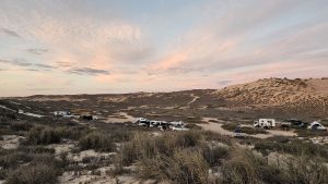
The portside town of Triabunna is best known as the gateway to wildlife sanctuary, Maria Island. If you’re keen to catch the first ferry of the day – like us, there’s a donation campsite behind the local pub for the night before. An overnighter on Maria Island will give you plenty of time to enjoy the main highlights, including:

Highlights:

  • Fossil Cliffs – 5km loop walk with epic coastline and stacks of ancient fossils.
  • Bishop and Clerk – challenging hike with spectacular summit views (4-5 hr, 11km return).
  • Painted Cliffs – absolutely stunning rock formation best viewed at low tide (we went late at low tide and we had it all to ourselves due to the 4pm ferry rush).
  • Wombat and wildlife spotting – dawn and dusk are prime wombat hours. We also spotted some devils.
  • Historic buildings – explore the old penitentiary and colonial ruins dotted around the island.
  • Plus, an island sunset at Darlington Bay and a fireside dinner in the camp kitchen (wood supplied, but you’ve gotta light it).

Where we stayed:

  • Spring Bay Hotel, Triabunna (donation)
  • Darlington Campground, Maria Island

Tips:

  • The Darlington Campground ($7 pp pn) is the best base to explore the north (above attractions).
  • Its camp kitchen has BBQs, gas cookers, and food storage lockers, meaning you can go fancier than dehydrated meals.
  • If you’re not up for camping, book the the Penitentiary Accommodation (it’s low-cost but sells out fast).
  • The more remote south deserves extra time (even if you’re cycling) and is home to two free camps (Frenchs Farm and Escarpment Cove).

Jump on the ferry back to Triabunna the next morning. Then hit the road north.

Mayfield Beach (35km, 1 day)

Highlights: 

  • Mayfield Bay Conservation Area – A popular stop-off on the Great Eastern Drive for coastal camping, with superb views across Great Oyster Bay, swimming, snorkelling and fishing. Tip: It’s a busy campsite, so arrive early.
  • Mayfield Estate – Mayfield is top-notch cellar door with ripper coastal views and the best cheese plate ever. Plus, it’s only minutes away from Mayfield campground.

Where we stayed:

  • Mayfield Campground, Mayfield Bay Conservation Area (free)

Coles Bay / Freycinet (75km, 4 days)

East Coast wine trail 

It’d be downright rude not to swing by a cellar door or two on your way up the coast from Mayfield. This stretch is serving up some seriously good vino and vibes.

Higlhights:

  • Devils Corner – Speccy views and DIY wine paddles in a sleek cellar door.
  • Craigie Knowe – the east coast’s oldest vineyard serving up delicious reds.
  • Spring Vale – Rustic charm and a fab guided tasting.

Tip:

  • The ‘town’ of Cranbrook packs four wineries within easy reach. Park up at the Craigie Knowe RV camp and taste away.

Meetus Falls

On your way up the coast, a detour to Meetus Falls (65km return) also makes for an exciting side trip. Take the Lake Leake Hwy turnoff just after Swansea. The Falls are located on McKay’s Road, 10km from the Lake Leake info booth.

  • Take the 15-minute return walk to the spectacular lookout or walk to the Cygnet River Lookout along the riverbed.
  • The road in is unsealed, potholed and gets rougher closer to the falls. If in a 2WD, park around 1km away (judgement call) on the roadside and walk in.
  • We wouldn’t recommend heading out to nearby Lost Falls as it predominantly runs dry (as we discovered).

Freycinet National Park

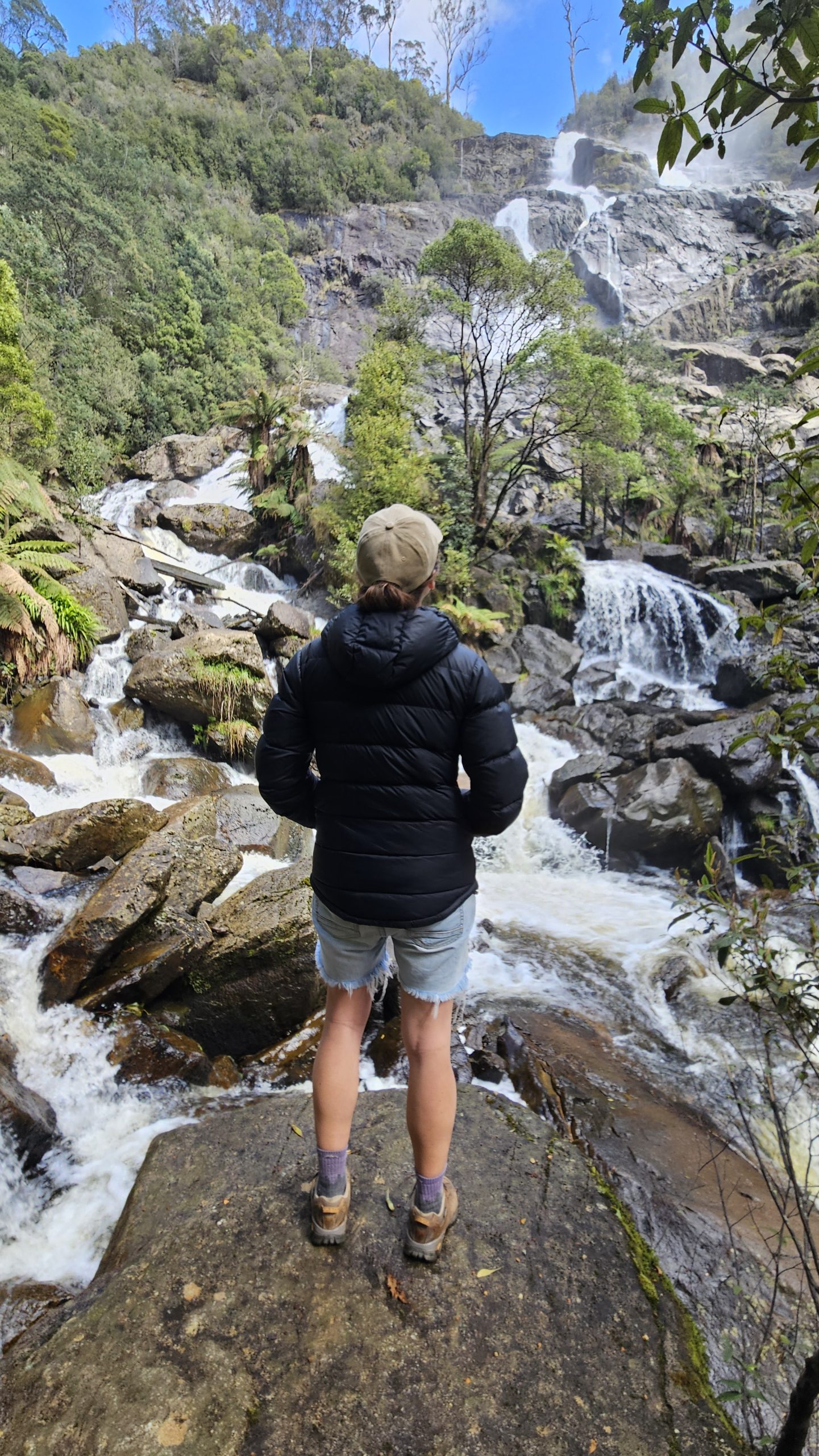
Experience the beauty of Freycinet National Park, with its sheltered bays and the dramatic granite peaks of the Hazards always in sight.

  • Wineglass Bay Lookout – A 1.5 km (30–45 min return ) walk rewards with sweeping views of the iconic bay.
  • Mount Amos – a steep and rocky scramble that rewards you with incredible views of the iconic Wineglass Bay (2-3 hours, 4km return, avoid in wet weather as very slippery).
  • Honeymoon Bay –  a tiny, secluded bay perfect for a refreshing swim or sunset picnic on the granite knoll.
  • Richardsons Beach Walk – 3.9km coastal walk from the visitor centre, with stunning mountain and ocean views.
  • Coles Bay – Enjoy a coffee or ice-cream from one of the lovely eateries in town.

Where we stayed

  • River Rocks Campground, Coles Bay (closest free camp to Freycinet)
  • Freycinet National Park Campground (coastal camp, power, water, showers)

Tips

  • There’s only 18 RV/car camping sites at Freycinet NP – the rest are ground tent only (so it can and does book out). We camped a couple of nights at the River & Rocks free campground (8km from Coles Bay) before snagging a spot at Freycinet NP
  • Book directly via Freycinet Visitor Centre (phone, email, or in-person)

Freycinet Peninsula Circuit hike

If you have the time, explore more deeply – like we did – by spending three epic days exploring the spectacular Freycinet Peninsula by foot.

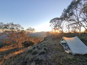
Cooks Corner camp (Day 1)

Sixteen kilometres of windswept coastline featuring the dramatic Hazards Range and the ever-present silhouette of Mt Freycinet, with a stunning trek across Hazards and Cooks Beaches and an optional 2-hour side trip to the wild, remote Bryans Beach. Stay at Cooks Corner for dinner in a cosy hut and easy access to water, or choose Bryans Beach for fewer people, shelter from the wind and breathtaking views.

Wineglass Bay camp (Day 2)

Tackle a 13 km, 7.5-hour trek that includes a rewarding climb up Mt Freycinet with sweeping coastal views (side-trip), followed by a challenging ascent of Mt Graham. After crossing open moorlands, descend into Graham Creek valley and continue to stunning Wineglass Bay, where you’ll camp behind the dunes among friendly kangaroos and possums.

Wineglass Bay car park (Day 3)

Start the final day with a relaxed 5 km trek along Wineglass Bay, taking in the surrounding peaks and turquoise waters. Finish with a climb of around 1,000 steps to the iconic Wineglass Bay Lookout for stunning views of the Freycinet Peninsula before heading to the car park.

Bicheno (40km, 1 day)

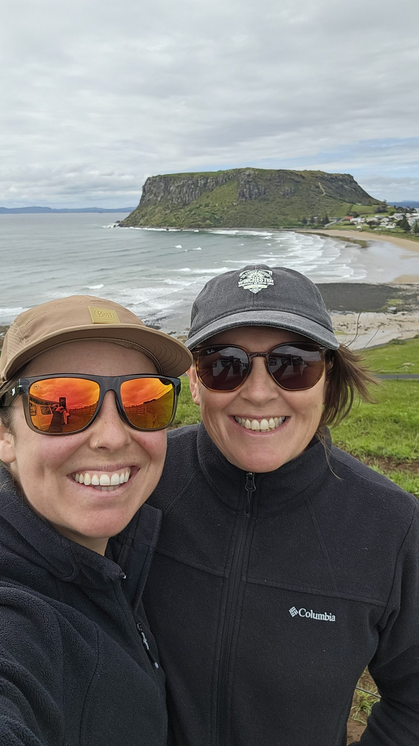
Bicheno is a laid-back coastal town known for its beautiful beaches, little penguins, rugged shoreline, and great local craft beer — a perfect stop on Tasmania’s East Coast.

Highlights:

  • Penguins — At dusk, head to the foreshore to spot Fairy Penguins (keep your distance and use a red light), or join a guided tour.
  • Bicheno Blowhole — A quick but fun stop, especially when the swell is up.
  • Diamond Island Nature Reserve — Walk across to the island at low tide for coastal views and wildlife.
  • Breweries — Visit Bicheno Brewing Co or Bicheno Brewing for top-notch Tasmanian craft beer.

Where we stayed

  • Pondering Frog Cafe RV site (donation)

Bay of Fires (75km, 2 days)

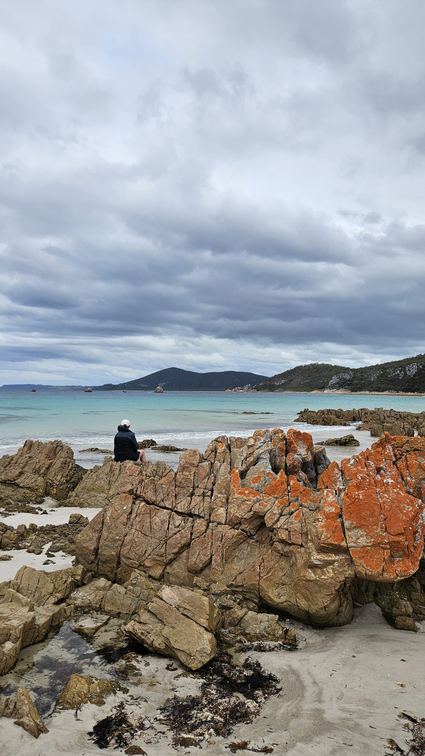
Here are some of our top spots to check out on your way north to the stunning Bay of Fires, where white beaches, clear blue seas, and iconic orange lichen-covered boulders await.

Douglas-Apsley National Park

Detour off the coast to visit this lesser-known national park – a highlight of our East Coast adventure and just 15km return from the highway.

  • Apsley River Waterhole & Gorge walk- 7km, 4-5 hr circuit, Grade 3.
  • Hike through Eucalyptus forest to the stunning Apsley George, where you can descend into the insanely beautiful riverbed and rock-hop back downstream.
  • Top it off with an icy dip in the turquoise waters of Apsley Waterhole.

Chain of Lagoons

A wildly beautiful, often deserted stretch of coastline between Freycinet and the Bay of Fires, perfect for a lunch pit stop, or an overnighter to break up the driving and hiking.

Saint Patricks HeadSt Marys

Take a detour off the coastal road to tackle the short Paddy’s Head climb in heritage town, St Mary’s (only a 17.5 km detour). After the hike, head north on the A4 to return to the coast.

  • Paddy’s Head summit hike -2 hrs, 3 km return, 683 m elevation.
  • The hike up Paddy’s Head will get your heart pumping and camera clicking, with a scramble, shaky ladder climb and 360° views of the coast and Fingal Valley.

Bay of Fires

  • Camping here is pure magic: Wake up to endless white sand, turquoise waters, and iconic orange boulders against the horizon — and it’s free!
  • Top spots include Binalong Bay (for stunning scenery) and Cosy Corner North (for a peaceful, off-the-beaten-path stay).
  • Kick back and explore – let nature leave you in awe.

Where we stayed:

  • Lagoons Beach Camping: Set up camp just steps from the rugged beach at this popular spot. Arrive early during peak times — it fills up fast!

Pyengana (53km, 1 day)

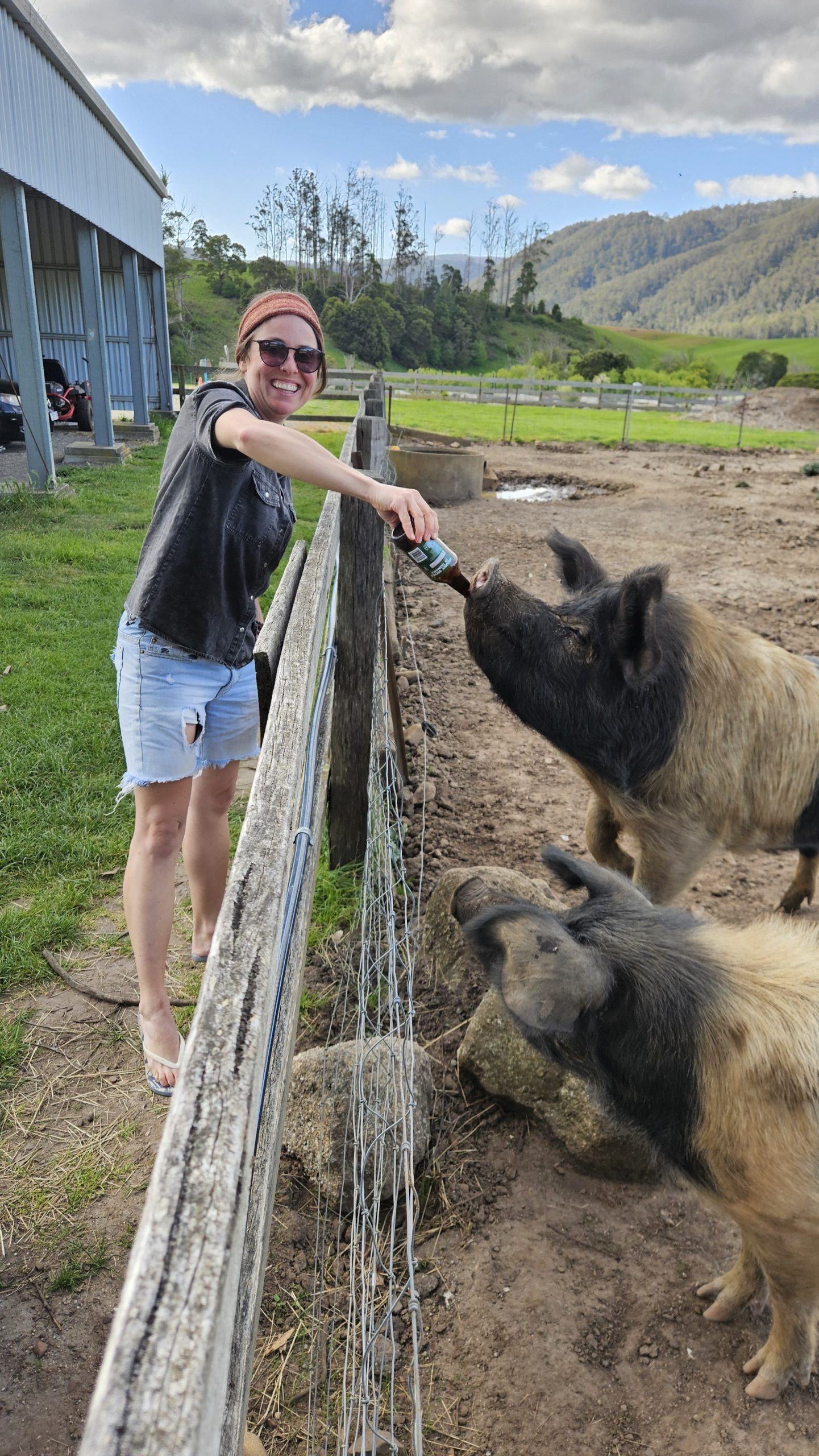
The Tassie hamlet of Pyengana offers a quirky mix of beer-swilling pigs, stunning waterfalls, and rolling vistas!

Highlights:

  • Pub in the Paddock – Enjoy a cold beer at this iconic pub surrounded by hills, and buy an ale for their friendly resident pigs.
  • Pyengana Dairy Factory – Savour handcrafted, award-winning cheeses and dairy products while soaking in the beauty of the valley.
  • St Columba Falls – A 30-minute, 1.2km return walk to a stunning waterfall, surrounded by lush rainforest. Easy and family-friendly, perfect for a quick stop.

Where we stayed:

  • Pyengana Rec Grounds (donation camp, with $2 hot showers – boom!)

Derby (41km, 2 days)

For those not towing, take the steep, narrow and picturesque back road from Pyengana to Ringarooma and tackle the 4km Cashs Gorge Circuit hike with stunning views of Ralph Falls and the gorge (adds 20kms). Alternatively, stick to the bitumen and head straight to Derby via Weldborough. While mountain biking put Derby on the map, there’s heaps to love about this character-filled historic town even if you don’t ride a deadly treadly.

Highlights:

  • Mountain Biking Trails – Hit up 170km of epic trails in this mountain biking haven.
  • Mount Paris Dam – Follow dusty roads to the old dam, where its massive concrete wall is being reclaimed by nature.
  • Walking trails – Explore stunning trails like the lake circuit, suspension bridge, and tunnel walk.
  • Floating Sauna – Unwind in Australia’s only floating wood-fired sauna, then plunge into the icy waters of Lake Derby for the ultimate refresh.
  • Little Blue Lake – Check out its vivid blue waters and capture unforgettable photos (50km return drive ).
  • Tin Timbers Café – Tuck into homemade pies at nearby Branxholm (the slow-cooked lamb pie is dangerously good and huge!).

Where we stayed:

  • Derby Bush Bath Retreat — a dreamy Hipcamp offering a rustic hut with open fire, and an outdoor bath overlooking the hills. Perfect for when Tassie’s weather bites.

Launceston (100km, 2 days)

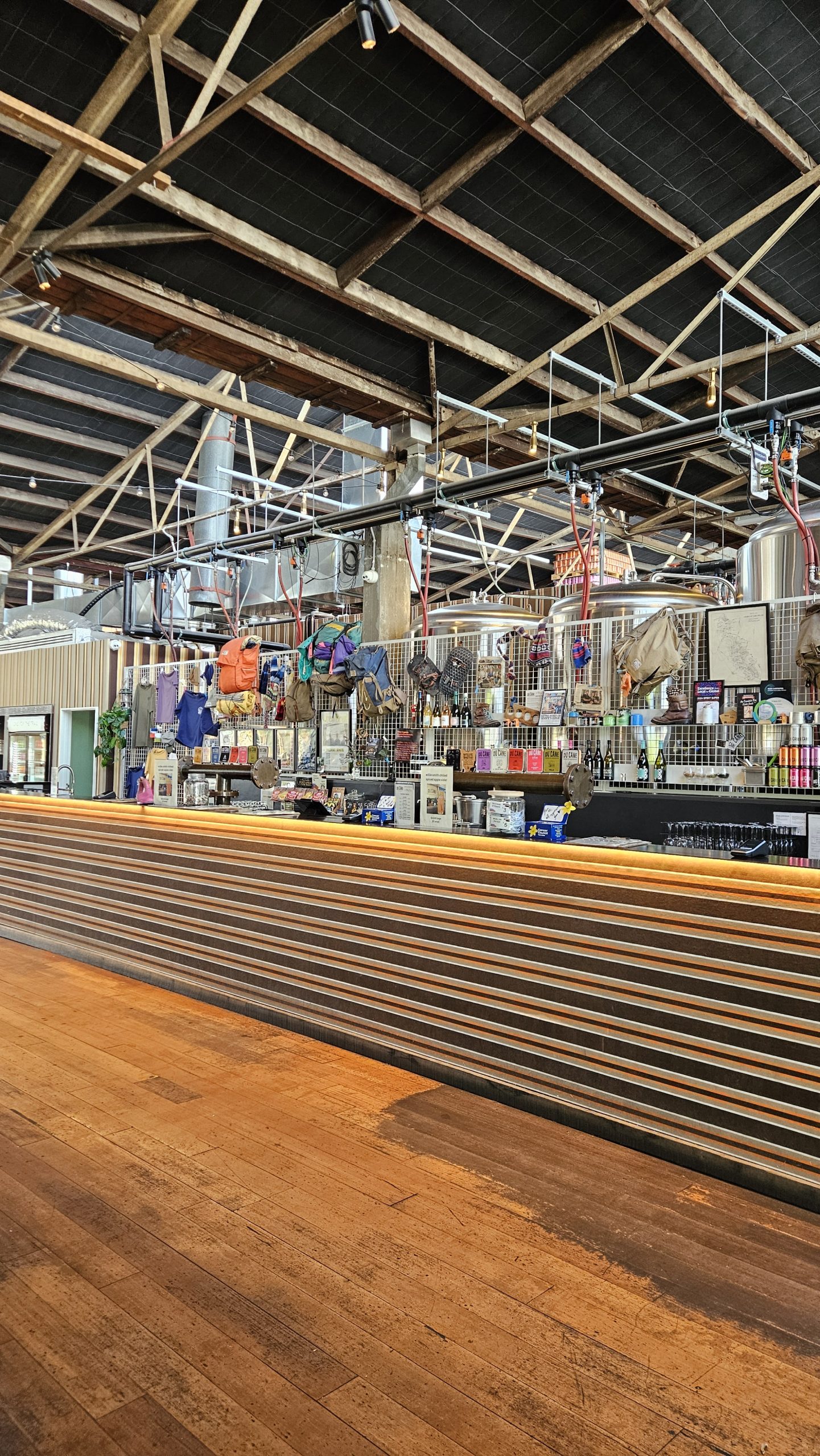
Spend a couple of days kicking around Launceston and enjoying dinner at one of its many lovely restaurants. We ditched the van and splashed out on a hotel stay.

Our ‘Launnie’ highlights:

  • Cataract Gorge Chairlift – Soar over the stunning Cataract Gorge on the longest single-span chairlift in the Southern Hemisphere.
  • Du Cane Brewery & Dining Hall – A great selection of craft beers brewed on-site, in honour of Tassie’s bushwalking culture.
  • Historic Streets – Stroll Launceston’s city streets, a treasure trove of architectural gems spanning centuries.
  • Tamar Valley Wine Trail – Explore picturesque vineyards, cellar doors, and world-class wines along the Tamar Valley Wine Trail.
  • Tamar Wetlands – Nestled just off the highway, this unexpected gem offers peaceful trails, incredible birdwatching, and stunning landscapes — a perfect nature escape!

Ben Lomond (120km return, 1 day)

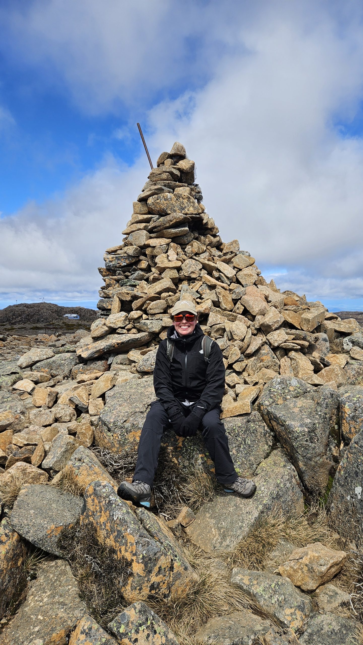
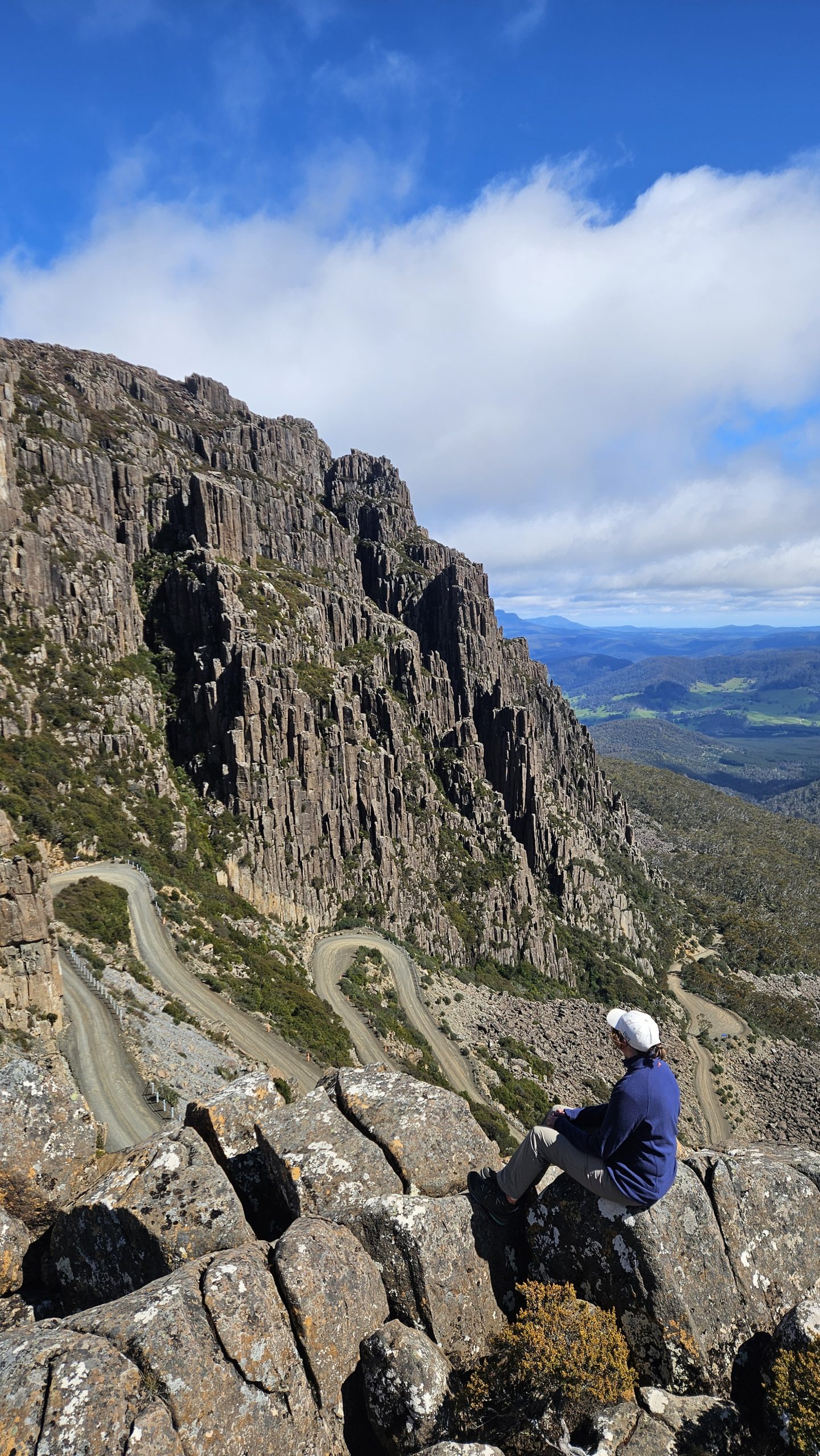
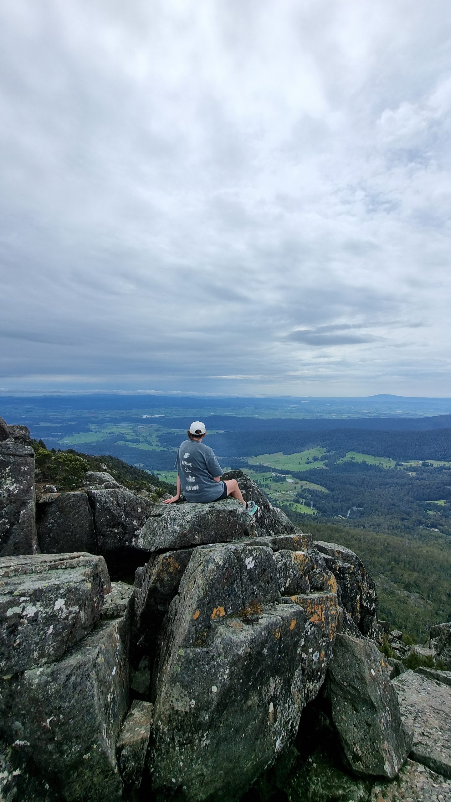
Winter might be Ben Lomond’s time to shine, but once the snow melts, a spectacular alpine landscape is revealed. It really is an all-season place to explore, with striking dolerite columns, colourful alpine plants, rock screes, and boulder fields dominating this 1,500m-high plateau.

We visited in spring and loved:

  • Jacob’s Ladder – Creep your way up this infamous road with switchbacks stacked on switchbacks, offering incredible views dropping away below.
  • Summit hike – Take the Ben Lomond Summit Link Track (new) + Legges Tor Summit Pass to Tassie’s second-highest peak (1,572m). Instead of returning the same way, we descended to the ski village (visible to the east from the summit) and followed the Link Track back circuit-style (4.5km, 1.5–2 hours).
  • Have more time? Check out: Alpine Village → Little Hell Track (1.5hr / 5.5km return) or Carr Villa → Legges Tor (3–5hr / 9km return).

Deloraine (51km, 2 days)

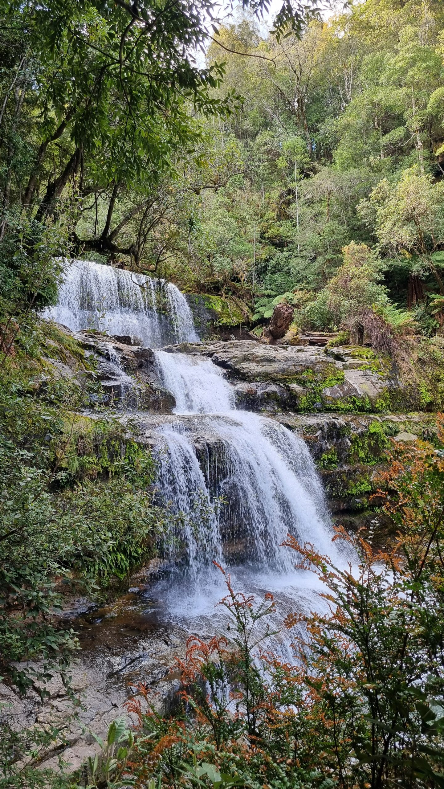
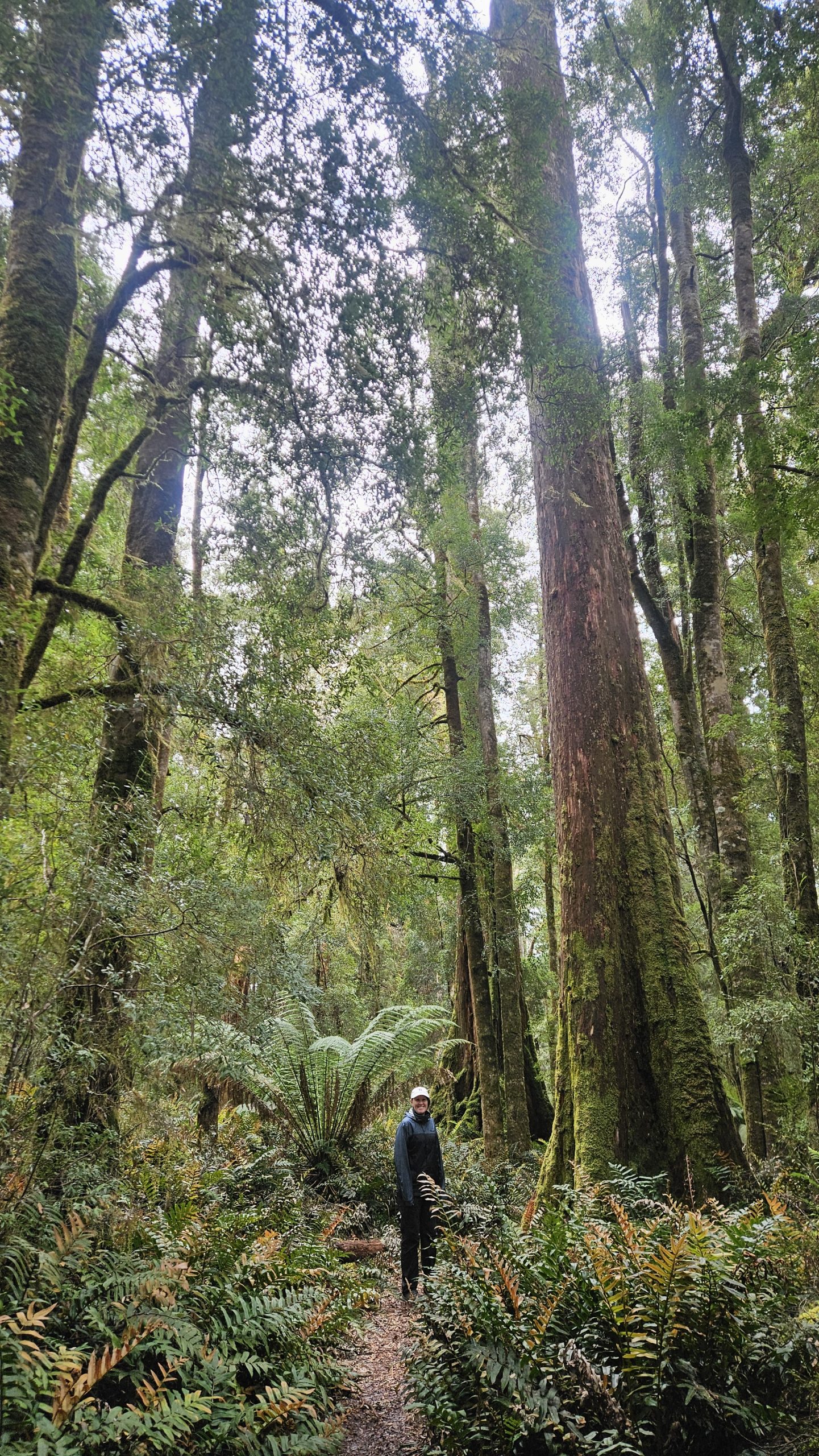
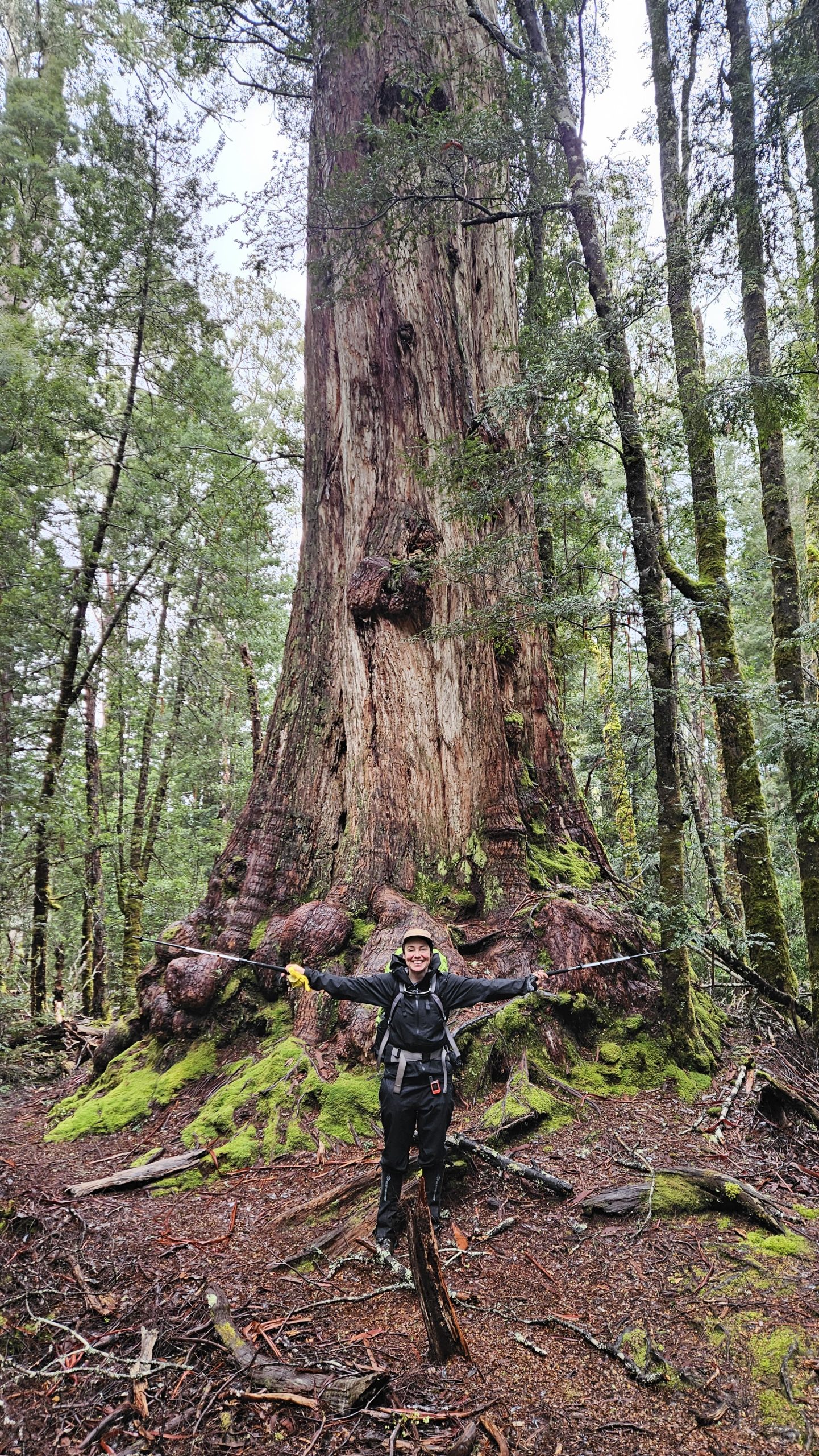
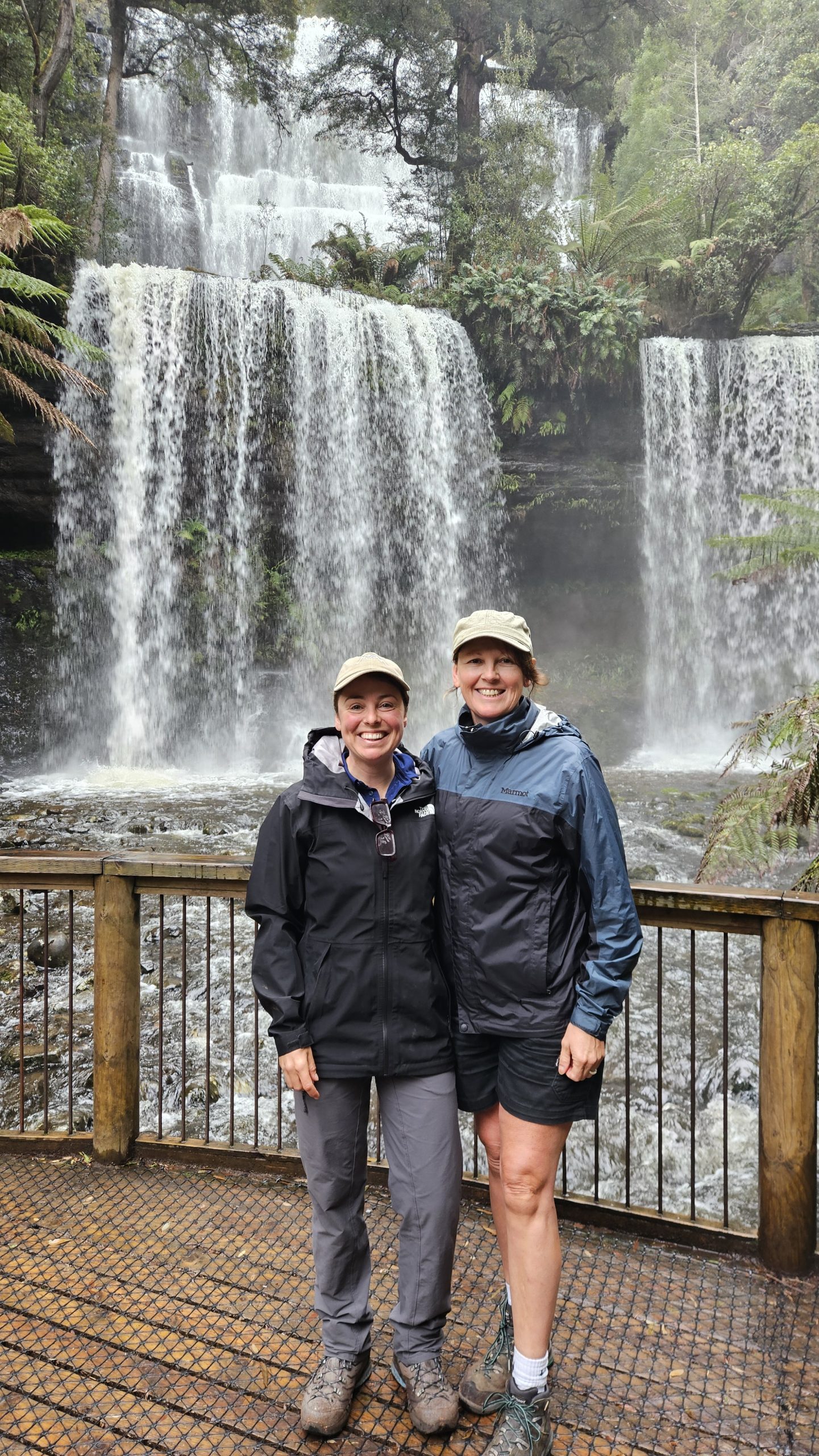
Deloraine is a vibrant, picturesque town brimming with art galleries, gorgeous cafés, and a stunning riverside backdrop, all framed by the spectacular Great Western Tiers. Just a stone’s throw from some of Tasmania’s most beautiful wild places, it’s the ideal location to spot an elusive platypus. Don’t miss Little Green Men Brewing Co, crowned Tasmania’s Best Bar — we can totally vouch for it. And here are a couple of breathtaking wild places to explore nearby.

Liffey Falls

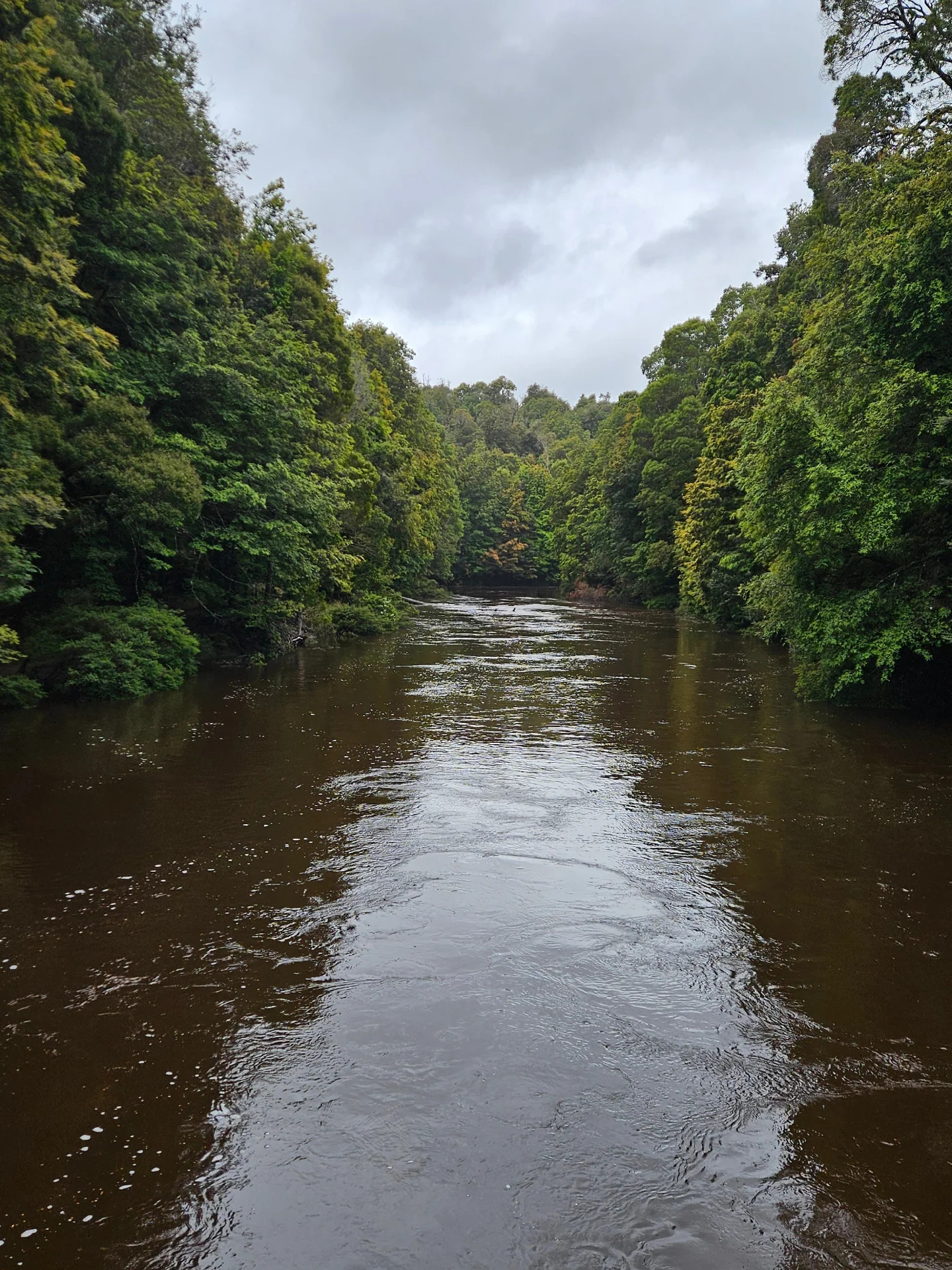
Nestled deep in mossy rainforest, it’s the kind of place that feels slow, cool, and ancient. A series of cascades tucked beneath the Great Western Tiers in Tassie’s Meander Valley. Liffey Falls walks – Choose from a 2 km return (45 min) trail from the upper carpark (quick + easy) or an 8 km return (3 hr) hike from the lower carpark (lush, peaceful, worth it). We took the longer trail, following the Liffey River through myrtle forest and under towering ferns, and didn’t come across another soul. It was magic.

Quamby Bluff

Some mountains greet you gently. Quamby Bluff (1,227m) isn’t one of them. Its steep, rocky spine rises sharply, asking you to earn the view — and we loved every boulder-hopping minute of it. Quamby is the northernmost peak in the Tasmanian Wilderness World Heritage Area and absolutely deserves a spot on your Tassie to-do list. Quamby Bluff Trail – From vast rock screes to rainforest pockets, the climb up is as memorable as the summit itself, which offers sweeping views across the Central Plateau and Great Western Tiers. Located in the Golden Valley (20 mins south of Deloraine), it’s a 6 km, 4–5 hr return Grade 3 hike.

Where we stayed:

  • Deloraine Self-Contained RV Rest Stop (very low cost)
  • Liffey Falls State Reserve campground (free, stunning)

Mole Creek (23km, 2 days)

The drive to Mole Creek takes you through the stunning Meander and Mersey Valleys — prime road trip territory with lush paddocks stretching beneath the towering Western Tiers. This entire area is magical, offering endless opportunities for exploration.

Meander Falls

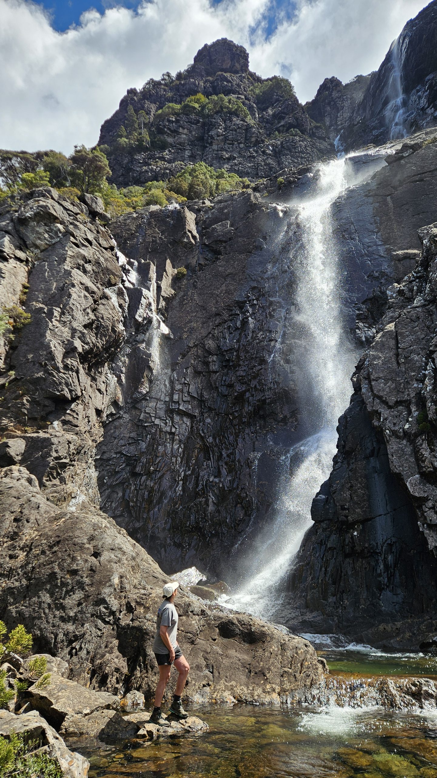
On the way to Mole Creek, stop by Meander Falls, one of Tassie’s most spectacular waterfalls, plunging through a cleft in the Great Western Tiers. Nestled in the Tasmanian Wilderness World Heritage Area (30 km south of Deloraine), it’s a must-see. The Hike: One of Tassie’s 50 great short walks, the 10 km, 4.5–6 hr return Grade 4 trail follows the spectacular Meander River, passing several small cascades before reaching the base of the 130m-high falls. The trail then continues higher, with absolutely stunning valley views.

Tips:

  • Grab a coffee from Meander Bridge Café before you head in.
  • The road to the falls trailhead is unsealed but 2WD-friendly.
  • Numerous other walks start from here — you could easily spend days exploring!
  • The trail markers to the higher cascades can be a bit hidden, so keep your eyes peeled.

Mole Creek Karst National Park

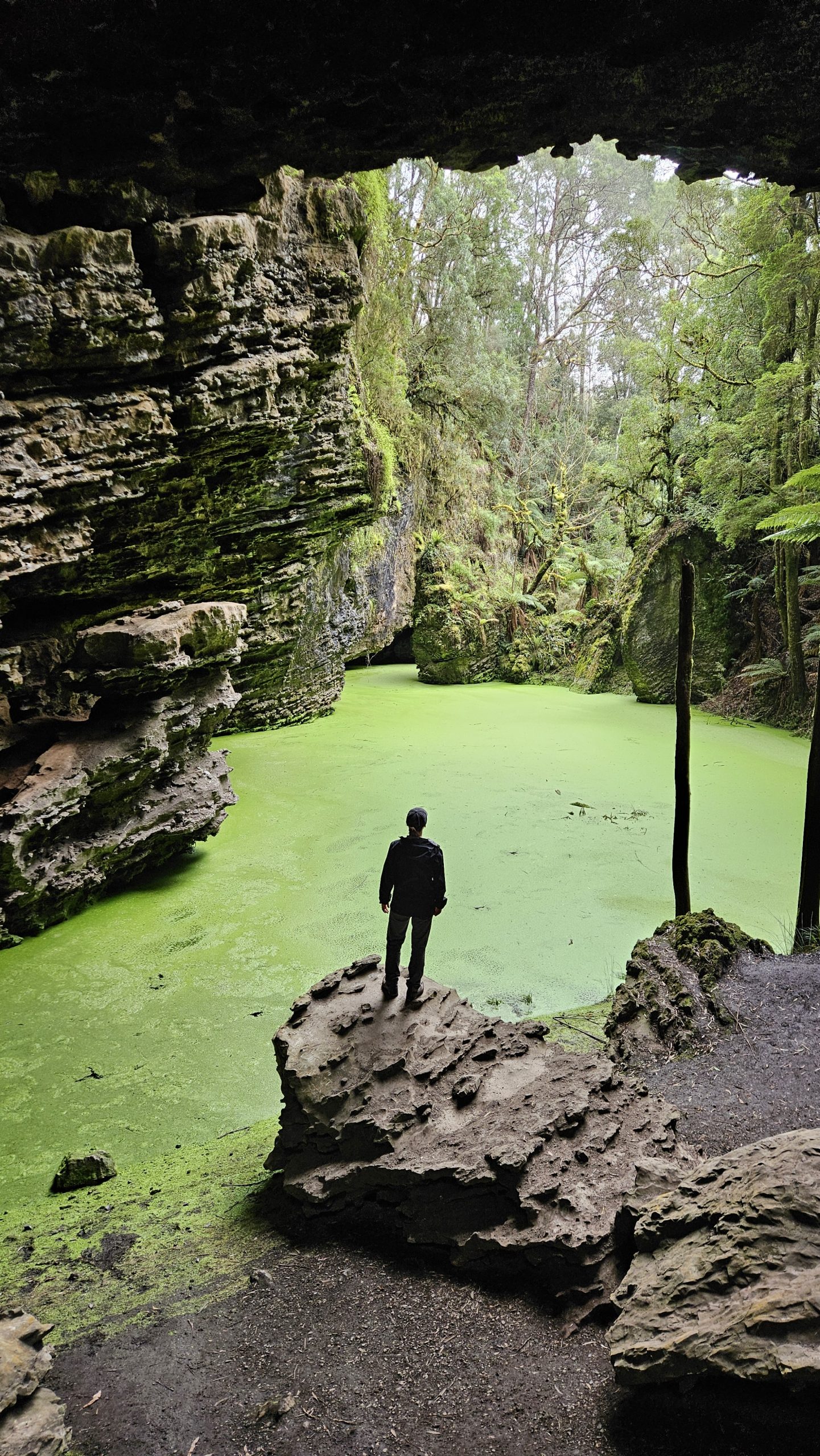
Spend a couple of days roaming this incredible landscape, shaped by water and time. Home to over 300 caves, the park is famous for Marakoopa and King Solomon’s Caves, but we ventured off the beaten track to explore a few lesser-known spots.

  • Honeycomb Caves: After rock-hopping across a creek, we explored a maze of passageways and rock formations by torchlight — no signs, no crowds, just us.
  • Westmorland Falls: A 2 hr, 4 km return walk through some of the most beautiful rainforest, leading to the base of the falls, where fossilized shells can be found in the rock.

Tip:

  • We based ourselves at the free Mole Creek Karst NP Campground, with both Westmorland Falls and Honeycomb Caves within walking distance. This campground is among our favourites, set amongst rolling green farmland, with Mother Cummings Peak stealing the show.

Central Plateau Conservation Area

  • Devil’s Gullet: Stand on the edge of towering cliffs and take in epic views over Tassie’s wild Central Plateau, with the likes of Cradle Mountain, Barn Bluff, and Mt Ossa unfolding on the horizon.
  • Parsons Falls: A hidden gem that feels like a remote Kimberley gorge, this icy cascade turns into a winter wonderland at 1,030m. A 1 hr, 3.5 km trail leads to jaw-dropping views where the water sparkles like magic.

Tips:

  • To get to Westmorland Falls: Follow the bend on Wet Cave Road (past the campground entrance) to the small car park. You can also walk in from the campground.
  • The main entry to Honeycomb Caves sits beside a small car park and info booth at the campground turn-off. (If you reach the campground itself, you’ve gone too far.)
  • To locate Parsons Falls, follow these directions: From Lake Mackenzie Rd, 150m from the lake, turn right onto a vehicle track and drive to the gate. Walk 2km to the water channels, turn right toward the Fisher River pipelines, then descend to the river. Follow it downstream to the top of Parsons Falls. The route to the base is steep and unmarked.

Where we stayed:

  • Mole Creek Karst NP Campground (free, spectacular)

Cradle Mountain (82 km, 1 day)

Leven Canyon, Nietta

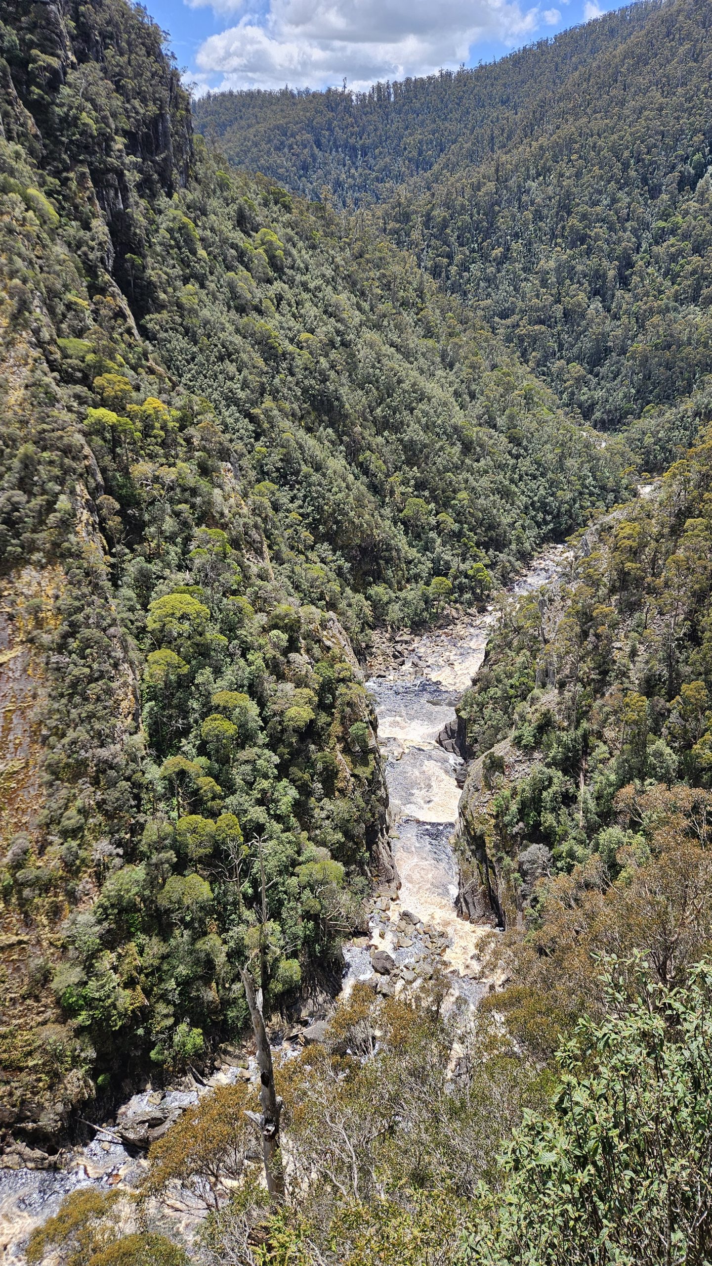
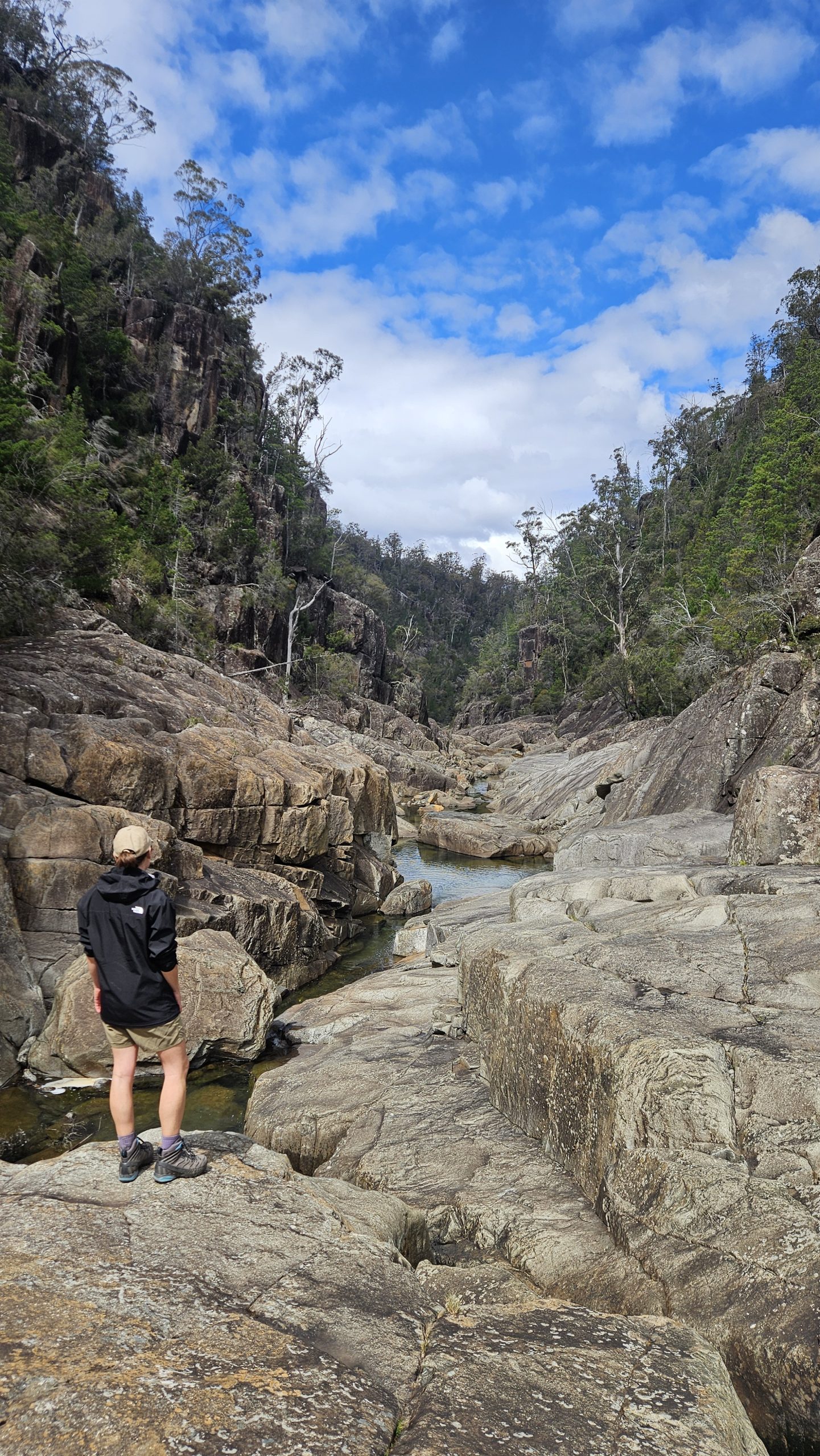
Leven Canyon offers a stunning detour (approx. 85 km return) on your way to Cradle Mountain. This lesser-known gem in northwest Tasmania features a dramatic 275-metre deep gorge. Stand above the wild, razor-sharp canyon at two lookout points, or venture down to the canyon floor via surprisingly accessible short trails.

  • Leven Canyon Lookout Walk – 1.2 km circuit, 45 min, Grade 3. Enjoy two scenic lookouts, 697 steps, and a fern-lined trail dotted with colourful fungi.
  • Leven Canyon Floor Walk – 1.9 km return, 1–2 hr, Grade 3. A steep, magical descent to the boulder-strewn canyon floor, followed by an upriver hike to Devil’s Corner.

Cradle Mountain-Lake St Clair National Park

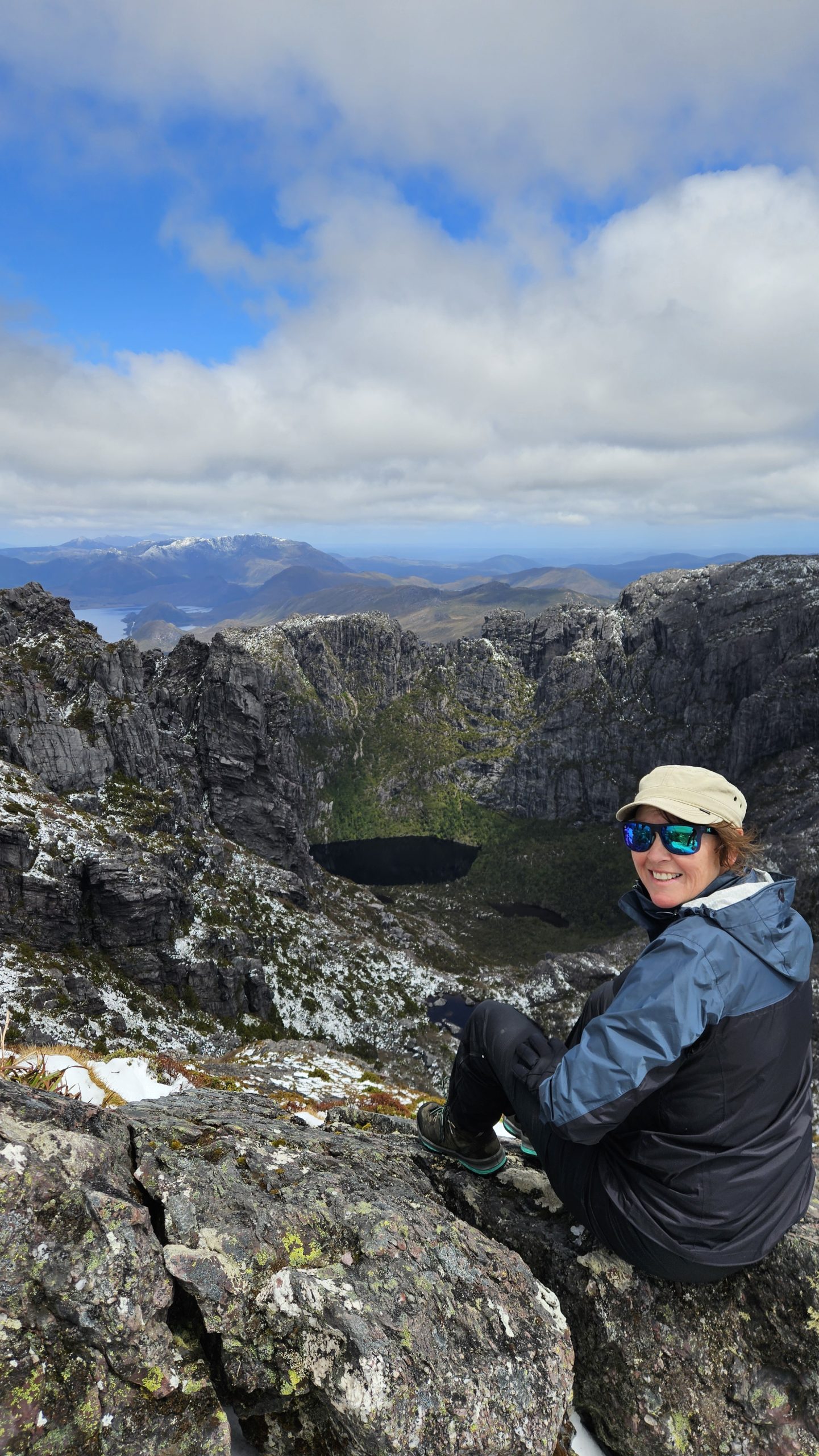
We explored this stunning alpine landscape on an epic seven-day, 80 km Overland Track adventure. If hiking’s your thing and the world-famous Overland Track is on your bucket list, check out our full journey here. But if a multi-day trek isn’t for you, don’t worry — the rugged beauty of Cradle Mountain can still be experienced in a day. No matter how you explore, it’s a place you can’t miss.

  • Dove Lake – Start at Ronny Creek, walk the boardwalk (wombat sightings are virtually guaranteed!), and make your way to Dove Lake for breathtaking views.
  • Marions Lookout – Add a side trip to Marions Lookout for sweeping views of Crater Lake, Dove Lake, and Cradle Mountain.
  • Summit Cradle Mountain (for the prepared) – For the truly adventurous, continue from Marions Lookout to summit Cradle Mountain itself — but this is no easy feat. Proper preparation, gear, and good weather are essential for a safe climb.

Where we stayed:

  • Discovery Resorts Cradle Mountain (fires in the camp kitchen will keep you toasty)

Boat Harbour (134 km, 2 Days)

On your way to Tassie’s rugged northwest coast, prepare to be wowed by two stunning waterfalls and your first taste of ancient Tarkine wilderness. Once you hit the coast, you’ll be greeted by an unexpected mix of vibrant blooms and rugged rock formations.

Waratah

  • Waratah Falls – A waterfall plunges into a dramatic gorge, right in the heart of town. Quick walk (120 min, 250 m) to the base, or soak in the views from Kings Park or the grand old Bischoff Hotel.
  • Philosopher Falls – Stunning multi-tier waterfall tucked in Tasmania’s Tarkine Wilderness. A 3.9 km hike (1–2 hrs) through ancient rainforest, with jaw-dropping views at every step.

Table Cape, Wynyard

A flat-topped volcanic plateau that packs a punch with stunning cliffside views, the iconic Table Cape Lighthouse, and the vibrant, seasonal beauty of Table Cape Tulip Farm. Don’t miss it when the flowers are in full bloom.

Rocky Cape National Park

Tucked on Tassie’s wild northwest coast, Rocky Cape is home to towering rock formations, hidden beaches, banksia groves, heath-covered hills, and ancient Aboriginal caves. We explored the southern section and stayed at the dreamy coastal hamlet, Boat Harbour.

  • Banksia Grove and Caves Loop – Wander through a sea of banksias, then hit the coast for Lee Archer and Wet Caves — ancient Aboriginal shelters (1–1.5 hrs, 2.7 km).
  • Anniversary Bay Circuit – Catch epic views of Rocky Cape’s rugged coastline and turquoise waters. Add optional detours to Lee Archer and Wet Caves for the full experience (3 hrs, 6.9 km).

Where we stayed:

  • Boat Harbour Beach Holiday Park (a picture-perfect spot to unwind after a day of exploring)

Tips:

  • Short on time? Stick to the coastal trails — they’re the highlights!
  • Doone Falls? Not our favourite, and the hike wasn’t worth it, but hey, beauty’s in the eye of the beholder.

Stanley (48 km, 2 days)

Dip Falls

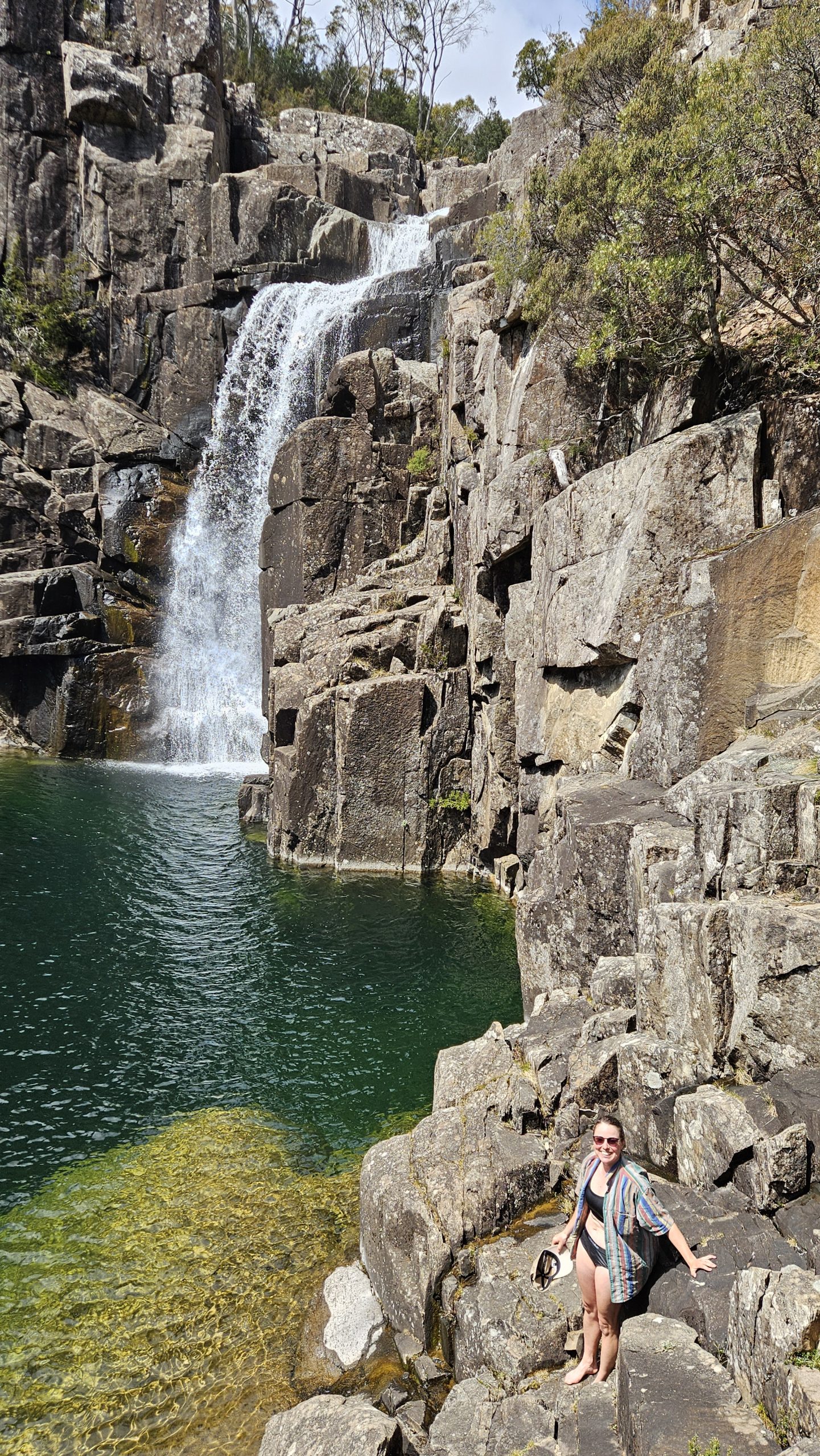
As you head west, don’t miss an epic detour to Dip Falls and the Big Tree — just 30 km return from the highway. Hidden in northwest Tassie, this massive waterfall thunders with raw power — impressively wide and loud.

  • Upper and Lower Falls Lookouts – Enjoy a short stroll to a bird’s-eye viewing platform, while dozens of steps lead to the base for an up-close view of the crashing water.
  • The Big Tree – A quick detour to see a 400-year-old Stringy Bark tree with a giant hollow, on a short but stunning rainforest walk.

Stanley

“Wow” is what you’ll say as you roll into Stanley. It feels like you’ve stepped into the Scottish Highlands — green hills, rolling farmland, and a vibe straight out of a fairytale. Hands down, we think it’s Tassie’s prettiest town.

  • ‘The Nut’ – This 143 m iconic peak towers over the town — an impressive backdrop, offering a heart-pumping but short climb, or a leisurely five-minute chairlift ride. Once at the top, take in jaw-dropping views of the rugged coastline.
  • Penguin viewing – Grab your puffer jacket and head to Godfreys Beach Viewing Platform at dusk to see dozens of Fairy Penguins waddling home. (Remember to use a red light and keep quiet.)
  • Stanley Heritage Walk – Wander the charming streets lined with heritage buildings, soaking up the old-world character (pick up a map at the Visitor Centre).

Where we stayed:

  • Stanley Recreation Ground RV Camp (low cost)

Corrina / Tarkine Wilderness (310 km, 4 days)

Tassie’s North West is home to the Tarkine wilderness — one of the world’s largest Gondwanan temperate rainforests and sacred Aboriginal cultural sites. Explore its old-growth forest, sweeping buttongrass plains, wild coast, tannin-stained rivers, mysterious sinkholes, and significant cultural artefacts via the Tarkine Drive (130 km, 20+ stops) and Western Explorer — aka the Road to Nowhere (100 km of mostly dirt).

Smithton (Tarkine Drive – Inland Rainforest Circuit)

A short 20 km drive will lead you to Smithton, a good base for the first leg of your Tarkine adventure. Using Smithton as a base, explore the Tarkine Drive’s rainforest circuit. This loop takes in 60 km of the drive, but you’ll clock up around 140 km getting to the start of the drive and back.

Highlights:

  • Fern-framed archway and sinkhole at Trowutta Arch, Julius River rainforest walks, views from Milkshake Hills

Where we stayed:

  • Tall Timbers RV Site, Smithton (free)

Tips:

  • If towing, leave your van parked at Smithton (it’ll make life heaps easier).
  • Short on time? You can tackle the Tarkine as a day trip by taking in Trowutta Arch (the most impressive inland site), then heading straight to the coast.

Arthur River (Tarkine Drive Coastal Route)

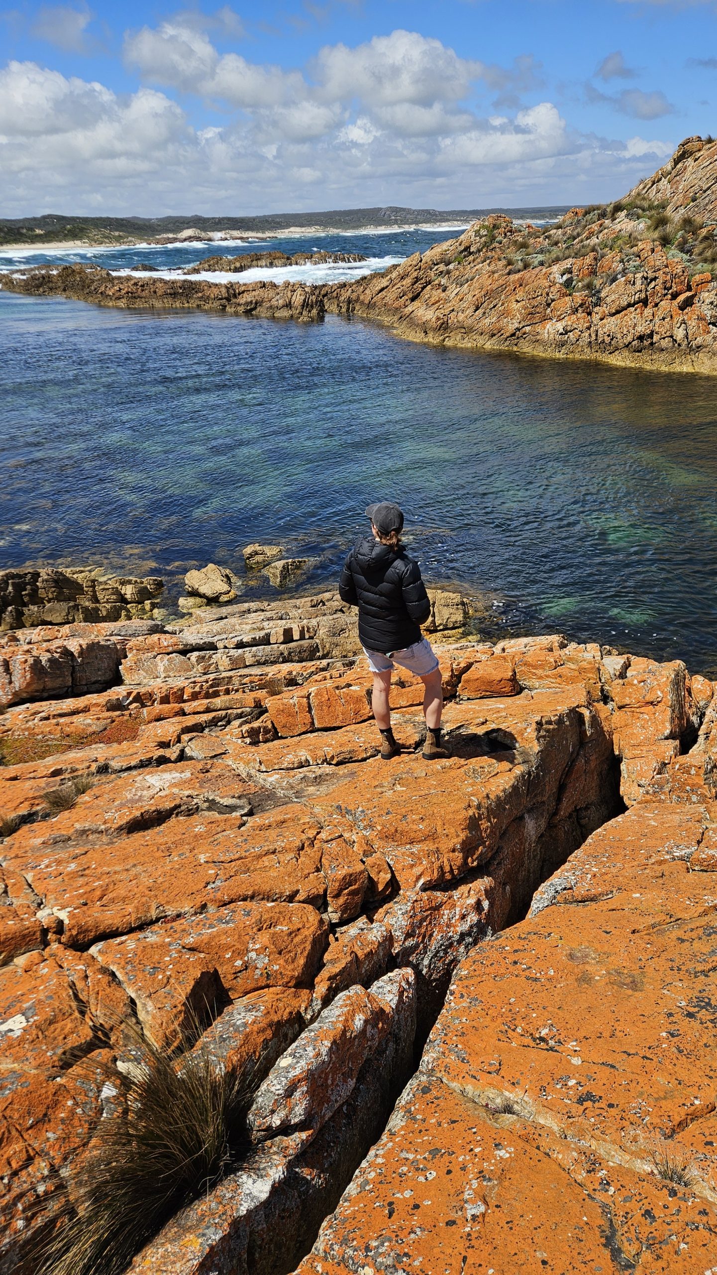
The second leg of your Takayna (Tarkine Drive) adventure will take you to Marrawah — Tassie’s westernmost community, then to the mouth of the Arthur River, where tannin-stained waters spill into the Southern Ocean. Tassie’s remote north-west coast is a rugged, windswept and wild place where solitude reigns, driftwood piles like sculptures, Tasmanian Devils roam, and 14,000 year-old petroglyphs tell stories of an ancient culture.

Spend a day or two roaming this coastline.

Highlights:

  • Spectacular coastal walk from Green Point to Preminghana (3hr return).
  • Exploring West Point’s bright orange, lichen-covered rock formations.
  • Standing at the ‘Edge of the World’ viewpoint, looking out over the longest uninterrupted
  • ocean stretch on earth.
  • The Petroglyph Coastal Walk (Sundown Point) — a wild coastline home to ancient Aboriginal
  • rock carvings.
  • A beer with friendly locals at the Marrawah Inn.

Where we stayed:

  • Green Point, Marrawah (free)
  • Prickly Wattle, Arthur River (low cost

Corrina (Road to Nowhere)

The ‘Road to Nowhere’ (Western Explorer) is a remote, windy 120km stretch of dirt road leading deep into the Arthur-Pieman Conservation Area. Windswept buttongrass plains, charred countryside, rolling hills and mountains, dark rivers, and ancient Tarkine forest — what adventures are made of. The bitumen fades into white gravel about 30km SE of Arthur River. No 4WD needed, but expect potholes (and take it slow if you’re in a hatchback!)

Highlights:

  • Detour to the abandoned mining town of Balfour, where you’ll find a curious pub without beer — a chilly 12v fridge waiting for visitors to BYO.
  • Camp beside the stunning Savage River – where a crackling fire will compliment the moody scene (keep an eye out for the endangered Grey Goshawk raptor).
  • If the weather is kind, kayak downstream from Corinna to Lovers Falls.
  • There’s plenty of short walks at Corinna, like the Savage River Walk, Whyte River Track and Old Telegraph Hill.

Where we stayed:

  • Savage River Overnighter (near Mount Donaldson Summit Walk trailhead)
  • There are clearings either side of the Savage River crossing suitable for small rigs (the
    northern side is the best of the two)

Tips:

  • If roughing it isn’t your thing, there’s also the option to stay at the Corinna Hotel (rooms and
    powered van sites)
  • Take the Fatman Barge over the Pieman River to continue your journey south (check the
    restrictions for caravan dimensions, essentially only smaller rigs)

Tullah (92km, 2 days)

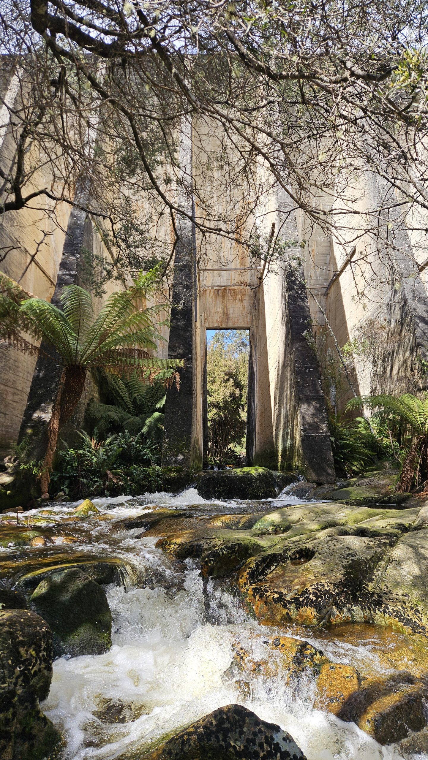
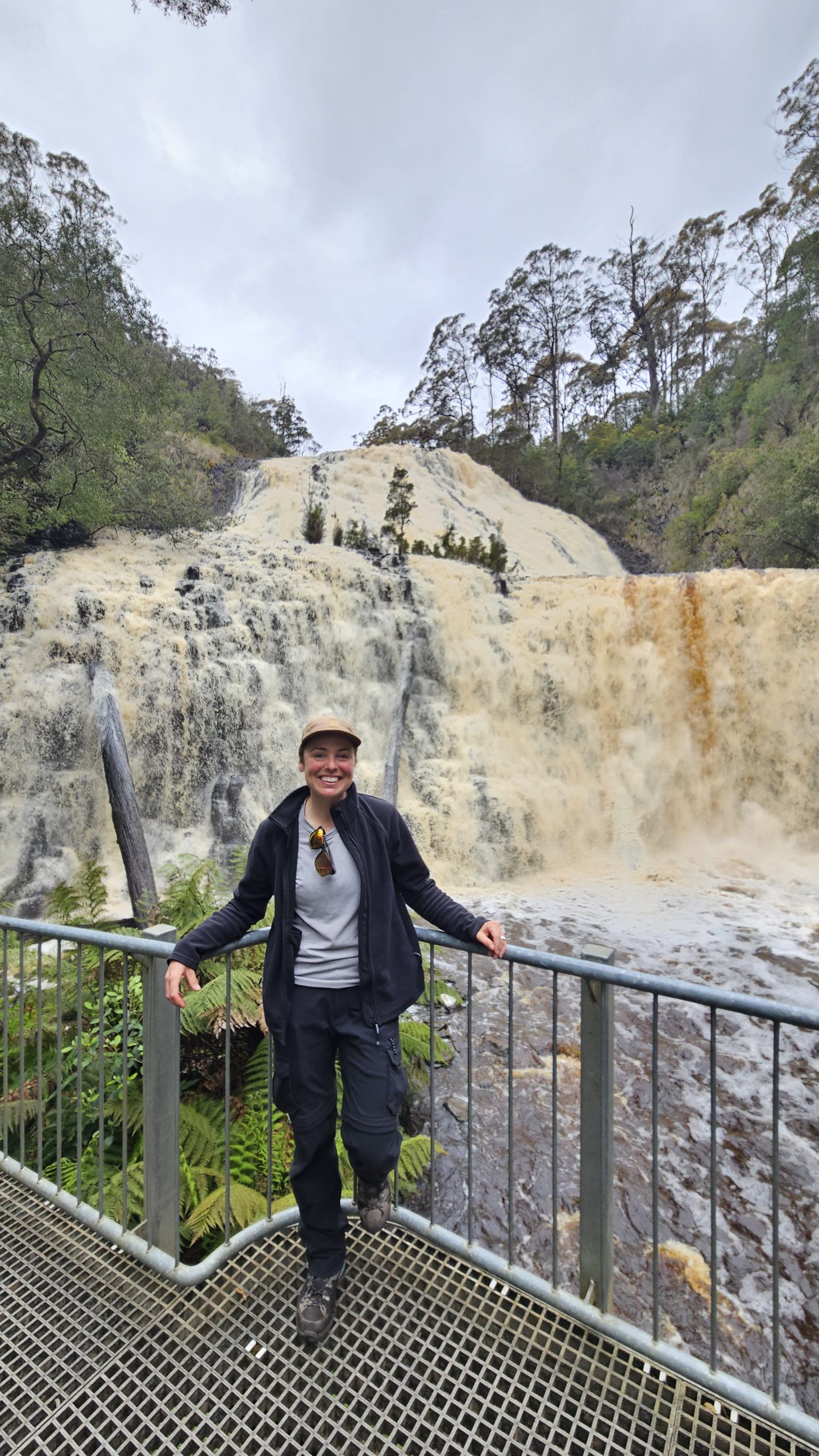
After crossing the Pieman River, you’ll quickly rejoin the bitumen. There are two routes to Tullah, but take the one via Zeehan — you won’t want to miss Montezuma Falls at Rosebery. Nestled on the shores of Lake Rosebery, at the foot of Mt Farrell, Tullah itself is an adventurer’s paradise. This quiet village is the perfect base for two epic mountain hikes.

Highlights:

  • Montezuma Falls: At 104m, this single-drop waterfall is a showstopper! You can view it from the swaying suspension bridge or a platform at the base — but be prepared to get drenched! One of Tasmania’s tallest waterfalls, the main track starts at Williamsford. It’s an easy 3-hour, 11.5km return walk (or cycle) through stunning rainforest.
  • Mt Murchison: Standing at 1,284m, this peak is now one of our all-time favorite day hikes. It’s steep, exposed, and challenging — but the 360° views from the summit are absolutely breathtaking. Starting at Lake Plimsoll/Anthony Road, be cautious in tackling; it’s a difficult Grade 4 hike with exposed ledges, vague trails, rock scrambles, and dangerous conditions in bad weather.
  • Mt Farrell: If you’re after something a little less intense, Mt Farrell offers stunning 360 degree views of Tullah, Lake Rosebery, Lake Herbert, and the wilderness beyond. Starting across from the Wee Georgie Wood Steam Railway, this Grade 3 hike takes 3-4 hours (9km return, or 8.7km and 1hr longer when including Lake Herbert).

Where we stayed:

  • Lake Rosebury Foreshore (free)

Mount Field National Park (275km, 2 days)

Lake St Clair

On the way to Mount Field, make sure to stop at Lake Saint Clair — a serene gem nestled in the heart of the Tasmanian Wilderness. Stretch your legs with a few of the scenic walks around the lake, where you’ll be surrounded by towering trees, crystal-clear waters, and dramatic mountain backdrops. It’s the perfect spot to take a breather before diving into the adventure of Mount Field.

  • Lake St Clair Walk – A beautiful, easy loop  (5.5km, 2 hrs) around the lake with stunning views of the water and surrounding forests.

Mount Field

A place where waterfalls cascade into lush rainforest, and rugged trails lead through forests alive with vibrant autumn colours. Whether you’re tackling a short, scenic stroll or pushing for a challenging summit, Mount Field National Park promises to be unforgettable.

Highlights:

  • Russell Falls: Possibly Tasmania’s most photographed waterfall, and it’s easy to see why! At 50m, this majestic cascade is bretahtaking and incredibly accessible — a 25-minute, 1.4km Grade 1 (wheelchair accessible) return walk from the Mt Field Visitor Centre leads to a viewing platform.
  • Three Falls Circuit: For a bit more adventure, tackle the 6km (2.5hr) Three Falls Circuit. This hike adds in Lady Barron Falls and Horseshoe Falls, offering even more beauty and adventure.
  • Fagus Viewing: If you’re visiting in late April to early May, don’t miss the fagus as its leaves transform into brilliant golds, reds, and oranges. The Lake Dobson Walk (3.5km, 1.5hrs) is a great way to experience it.

Where we stayed:

  • Mt Field Campground ($2 hot showers, gets busy in summer and weekends)

Tip:

  • Camping overnight? Don’t miss the glow worms on your walk to Russell Falls — it’s a magical sight!

 The final stretch

From here, head to your place of departure. For us, this was back to Devonport and aboard the Spirit of Tasmania.

Tip:

  • We opt for the overnight ferry and book a cabin so we can sleep away most of what is a pretty dull cruise and arrive fresh on the mainland, ready for a big drive.

Share:

More posts

Want to roam with us?

Sign up to receive our latest travel stories, tips, tricks and destination guides.

Want to roam with us?

Sign up to receive our latest travel stories, tips, tricks and destination guides.

We honour the ancient cultures of the First Nations peoples whose land we travel.

Copyright © Franky Roams | 2026 | All Rights Reserved